
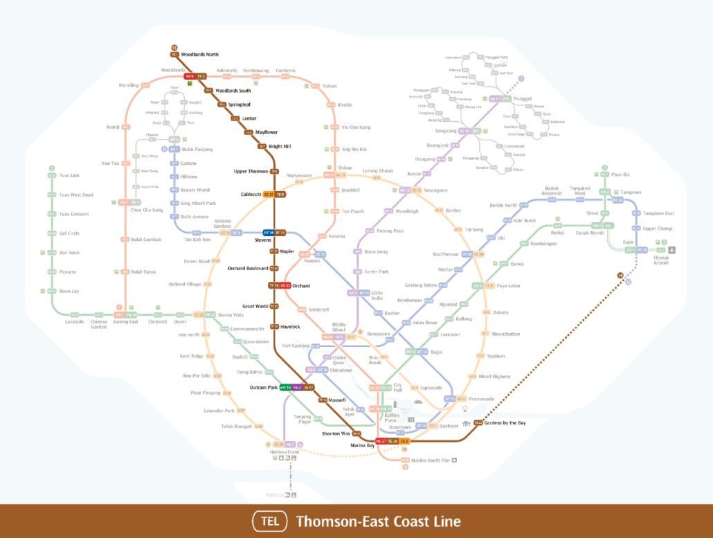
Full Thomson East Coast Line guide: every station, interchange and the route in one place.
The Thomson-East Coast Line is one of Singapore’s newer MRT lines, running from the north of the island through the city centre and out to the east coast. The MRT map shows how it connects a wide range of neighbourhoods, from Woodlands and the Central Business District to the Marine Parade area and beyond.
About the Thomson-East Coast Line
The Thomson-East Coast Line is the brown line on the map, with the code TE. It is fully driverless and run by SMRT. It has 27 open stations from Woodlands North (TE1) to Bayshore (TE29), opened in four stages between January 2020 and June 2024. From the north it runs through Woodlands, Springleaf, Caldecott and Stevens to Orchard, then through Outram Park and Maxwell to Marina Bay and Gardens by the Bay, before following the east coast through Katong Park, Marine Parade and Siglap.
Interchanges and what is next
Useful interchanges include Woodlands and Orchard for the North South Line, Caldecott for the Circle Line, Stevens for the Downtown Line, Outram Park for the East West and North East Lines, and Marina Bay for the North South and Circle Lines. Stage 5, with Bedok South (TE30) and Sungei Bedok (TE31), is due in the second half of 2026. Mount Pleasant, Marina South and Founders’ Memorial are not open yet, so trains pass through without stopping.
See the Thomson-East Coast Line guide for all of its stations.
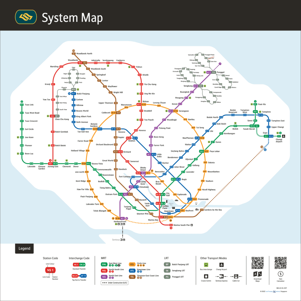
For the official version, see the LTA rail network map.
Getting around Singapore? Find any station on the interactive MRT map, or save the PDF map to use offline.