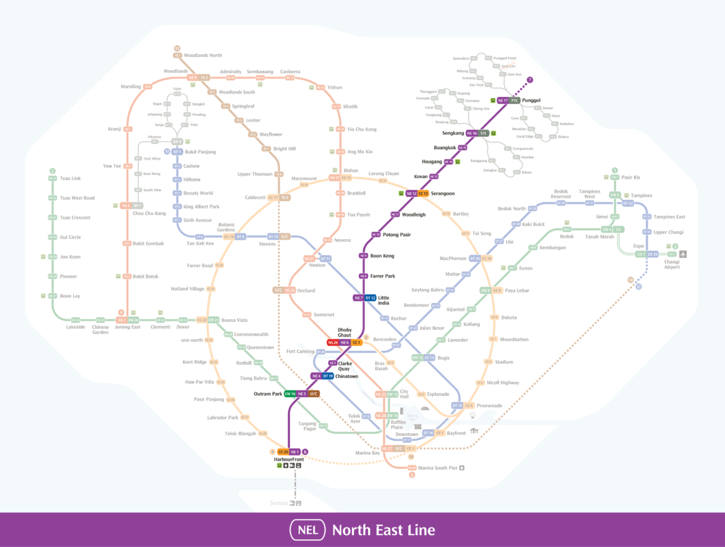
This North East Line map shows all 17 stations on the purple line, from HarbourFront (NE1) to Punggol Coast (NE18).
The North East Line runs from HarbourFront in the south to Punggol Coast in the northeast, covering 17 stations along a single purple line. It passes through some of Singapore’s most recognisable areas, including Chinatown, Little India and Serangoon. This map shows you where to board, alight and interchange along the route.
The North East Line is operated by SBS Transit and connects several major interchange stations, making it a practical choice for cross-island travel. At Dhoby Ghaut you can switch to the North South Line or Circle Line, and at HarbourFront you can connect to the Circle Line. Serangoon also gives you access to the Circle Line, while Outram Park links you to the East West Line and the Thomson-East Coast Line.
Clarke Quay station puts you a short walk from the Singapore River, which gets busy in the evenings. Chinatown and Little India stations are both within easy walking distance of their respective conservation areas, temples and local food options. Punggol station also connects to the Punggol LRT, making it straightforward to continue into the surrounding estate.
Punggol Coast NE18, the newest station on the line, opened on 10 December 2024 and extended the line further into the growing Punggol area. The map above shows all 17 stations in order, along with interchange connections to help you plan your trip. Check the full MRT line guide if you need a broader overview of the network.
North East Line map: key interchanges
On the North East Line map you can change to the Circle Line at HarbourFront, Dhoby Ghaut and Serangoon, the East West Line and Thomson-East Coast Line at Outram Park, the Downtown Line at Chinatown and Little India, and the North South Line at Dhoby Ghaut. Sengkang and Punggol connect to their LRT loops. The line is driverless and run by SBS Transit. See the North East Line guide for every station.
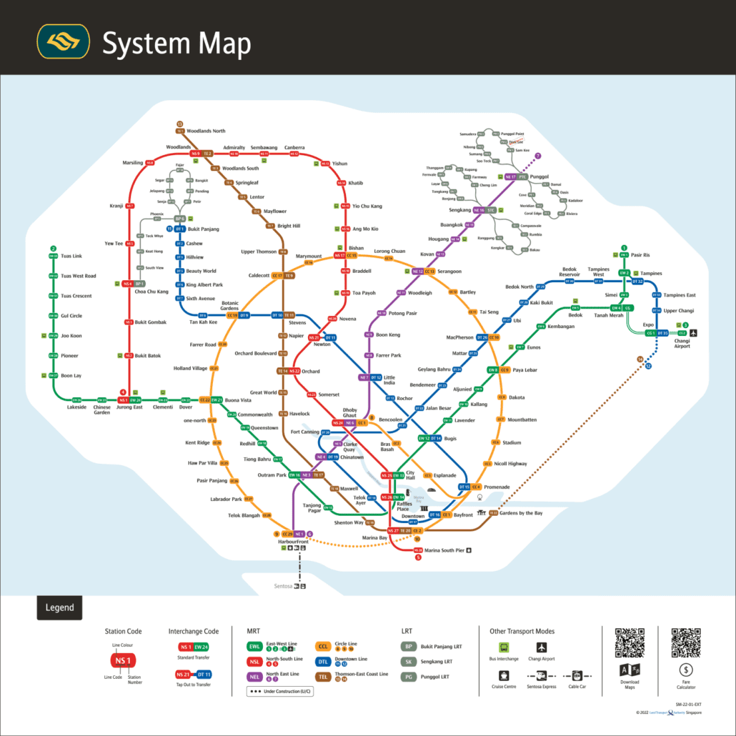
The network today: the official LTA system map for 2026.
The MRT Map of Singapore Editorial Team keeps the site's interactive MRT map, line guides and train times up to date using official LTA, SMRT and SBS Transit information. News posts are drafted with AI tools from published reports and official announcements. Spot a mistake? Tell us through our contact page and we will fix it.