
View the official map (LTA MRT)
- STC
- PTC
- BP1
11
12
directions_bus
- 1 bukit panjang
- 2 cashew
- 3 hillview
- 5 beauty world
- 6 king albert park
- 7 sixth avenue
- 8 tan kah kee
- 9 botanic gardens
- 10 stevens
- 29 bedok north
- 28 kaki bukit
- 27 ubi
- 26
- 25 mattar
- 24 geylang bahru
- 23 bendemeer
- 22 jalan besar
- 21 bencoolen
- 11
- 12 little india
- 13 rochor
- 14 bugis
- 15
1
2
3
- 21 buona vista
- 20 commonwealth
- 19 queenstown
- 18 redhill
- 17 tiong bahru
- 16 outram park
- 15
tanjong
pagar
- 1 pasir ris
- 2 tampines
- 3 simei
- 4 tanah merah
- 5 bedok
- 6 kembangan
- 7 eunos
- 8
- 9 aljunied
- 10 kallang
- 11 lavender
- 12
- 13
city
hall - 14
- CG
- 1
- 2 changi airport
4
5
- 13 yishun
- 14 khatib
- 15 yio chu kang
- 16 ang mo kio
- 17 bishan
- 18 braddell
- 19 toa payoh
- 20 novena
- 21 newton
- 22 orchard
- 23 somerset
- 24
- 25
-
raffles
place26 - 27
- 28 marina south pier
6
7
8
9
10
- 15
- 14 lorong chuan
- 13 serangoon
- 12 bartley
- 11 tai seng
- 10 macPherson
- 9 paya lebar
- 8 dakota
- 7 mountbatten
- 6 stadium
- 5 nicoll highway
- 4 promenade
- 1 bayfront
- 2 marina bay
- one-north23
- kent ridge24
- haw par villa25
- pasir panjang26
- labrador park27
- telok blangah28
- harbourFront29
- caldecott17
- 19


Welcome to the Ultimate Singapore MRT Map (2026 Edition)
Navigating the Lion City has never been easier. Whether you are a daily commuter or a tourist exploring for the first time, our interactive 2026 Singapore MRT and LRT map is your ultimate transit guide. Fully updated to reflect the latest Land Transport Authority (LTA) network expansions—including the newest Thomson-East Coast Line (TEL) stations and the completed Circle Line loop—this map helps you find the fastest route to your destination.
Pro Tip: Bookmark this page or download our high-resolution Singapore MRT Map PDF for offline use while traveling underground!
MRT Map Singapore Guides
Singapore river & bay areas.
River & bays are marked with dotsStandard Transfer
- 27 2
Tap Out to Transfer
- 21 11
East-West Line
- 1 2 3flight
- Code: EW
- Color: Green
North-South Line
- 4 5
- Code: NS
- Color: Red
North East Line
- 6 7
- Code: NE
- Color: Purple
Circle Line
- 8 9 10
- Code: CC/CE
- Color: Orange
Downtown Line
- 11 12
- Code: DT
- Color: Blue
Thomson-East Coast Line
- 13 14
- Code: TE
- Color: Brown
LRT - Light Rapid Transit
Bukit Panjang LRT
- BP
- Code: BP1/6
- Color: Gray
Sengkang LRT
- SK
- Code: STC
- Color: Gray
Punggol LRT
- PG
- Code: PTC
- Color: Gray


 zoom_in
 zoom_in
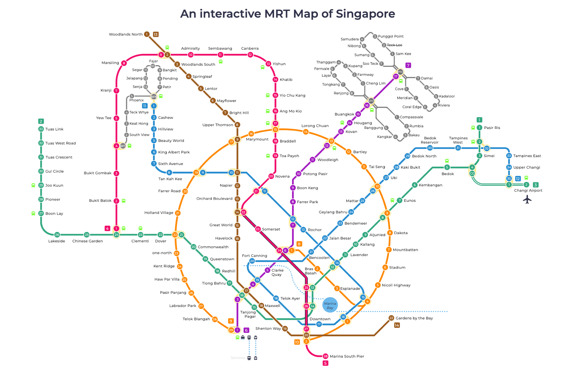 zoom_in
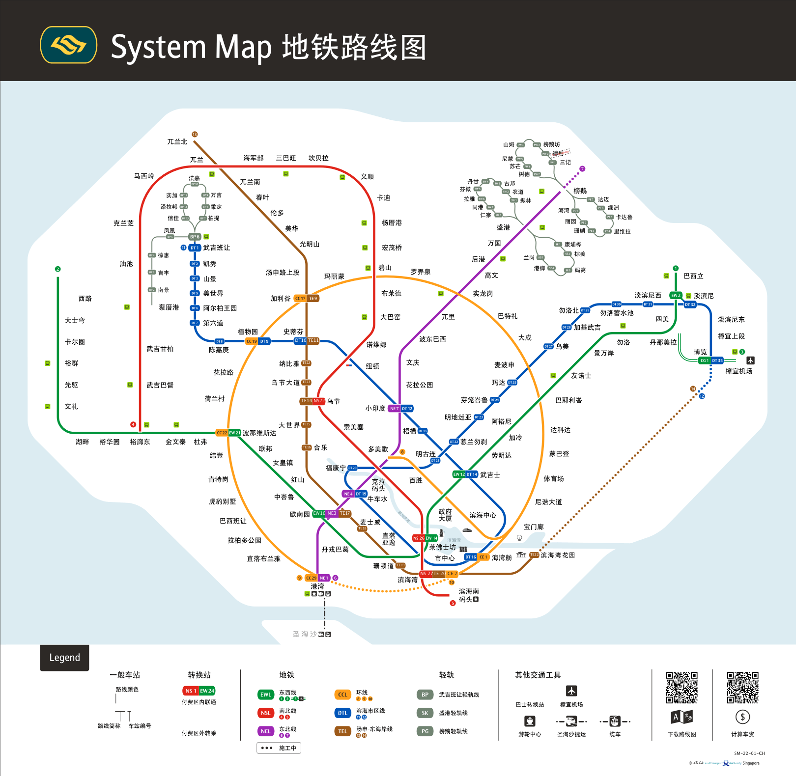 zoom_in
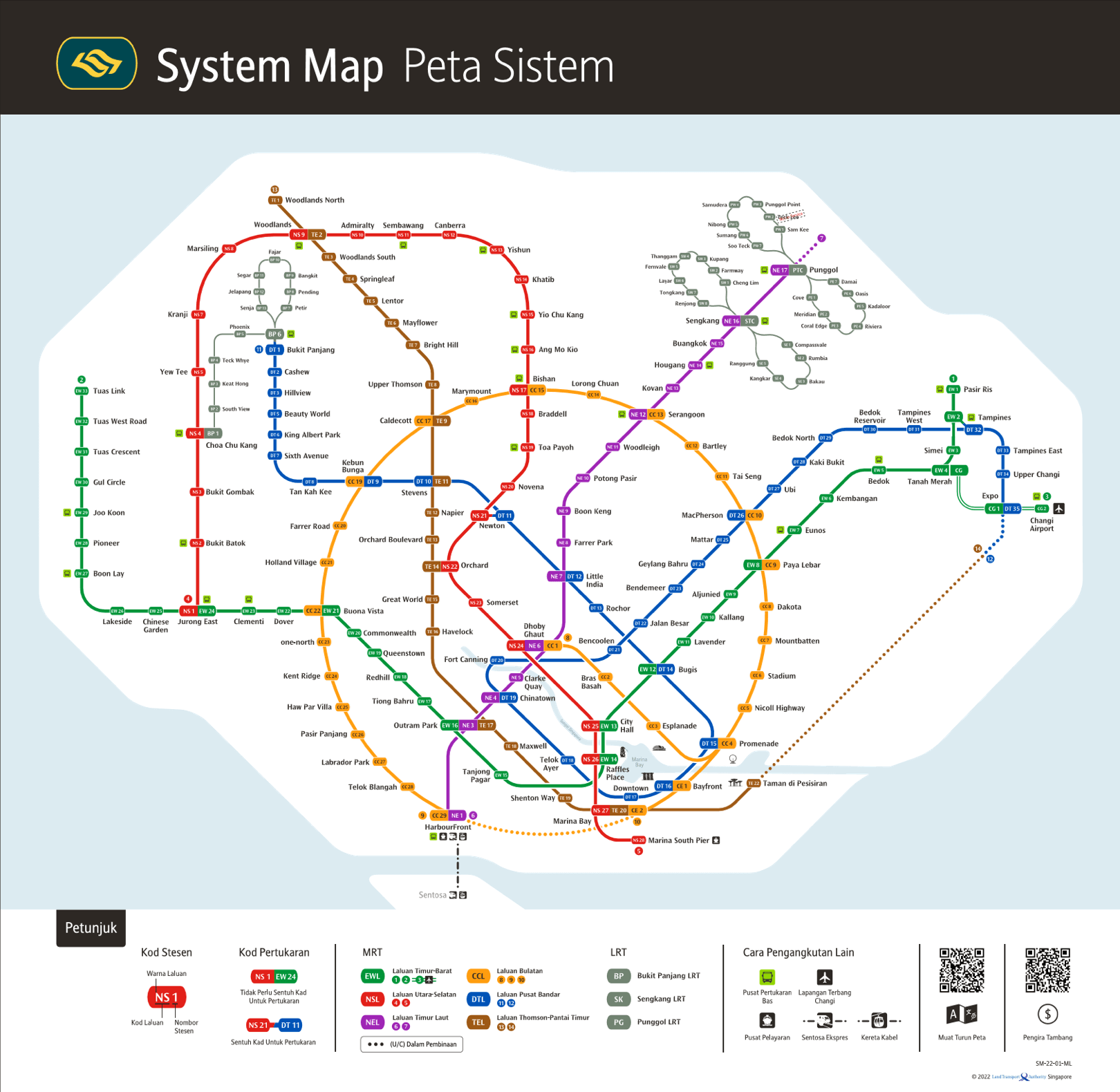 zoom_in
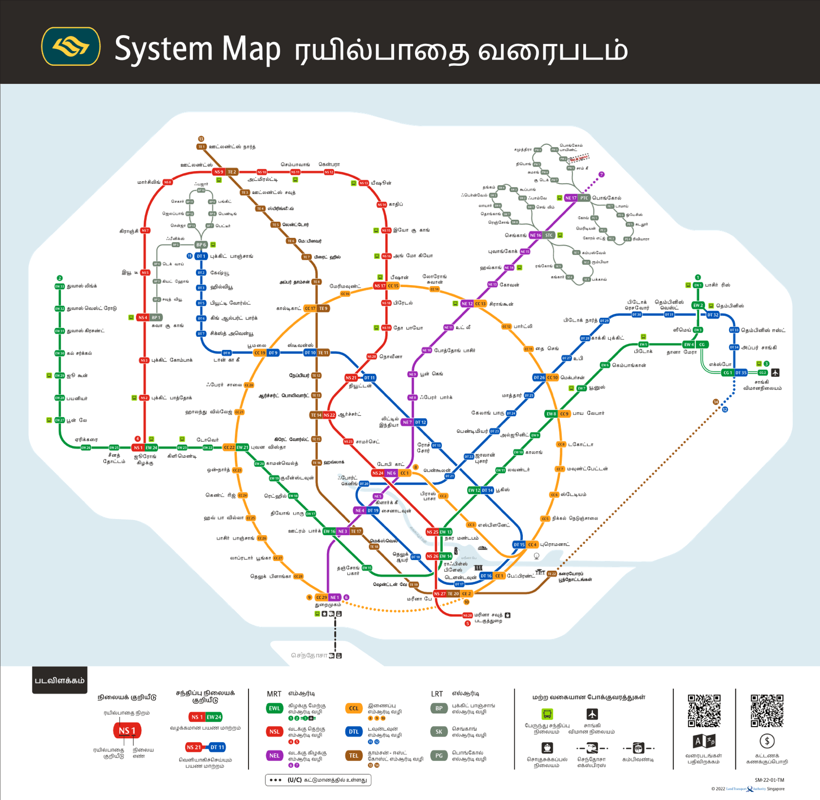 zoom_in
 zoom_in
 zoom_in
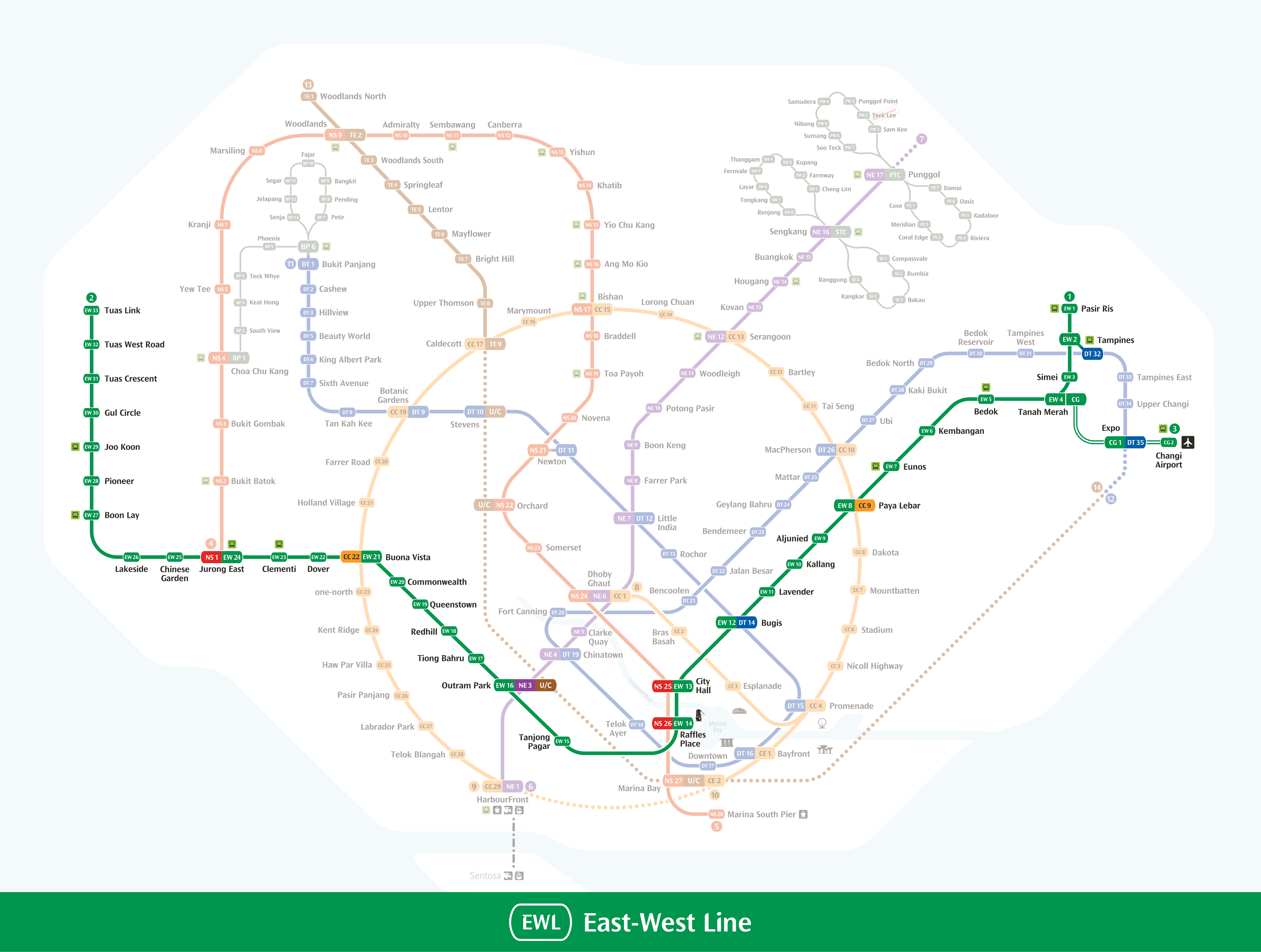 zoom_in
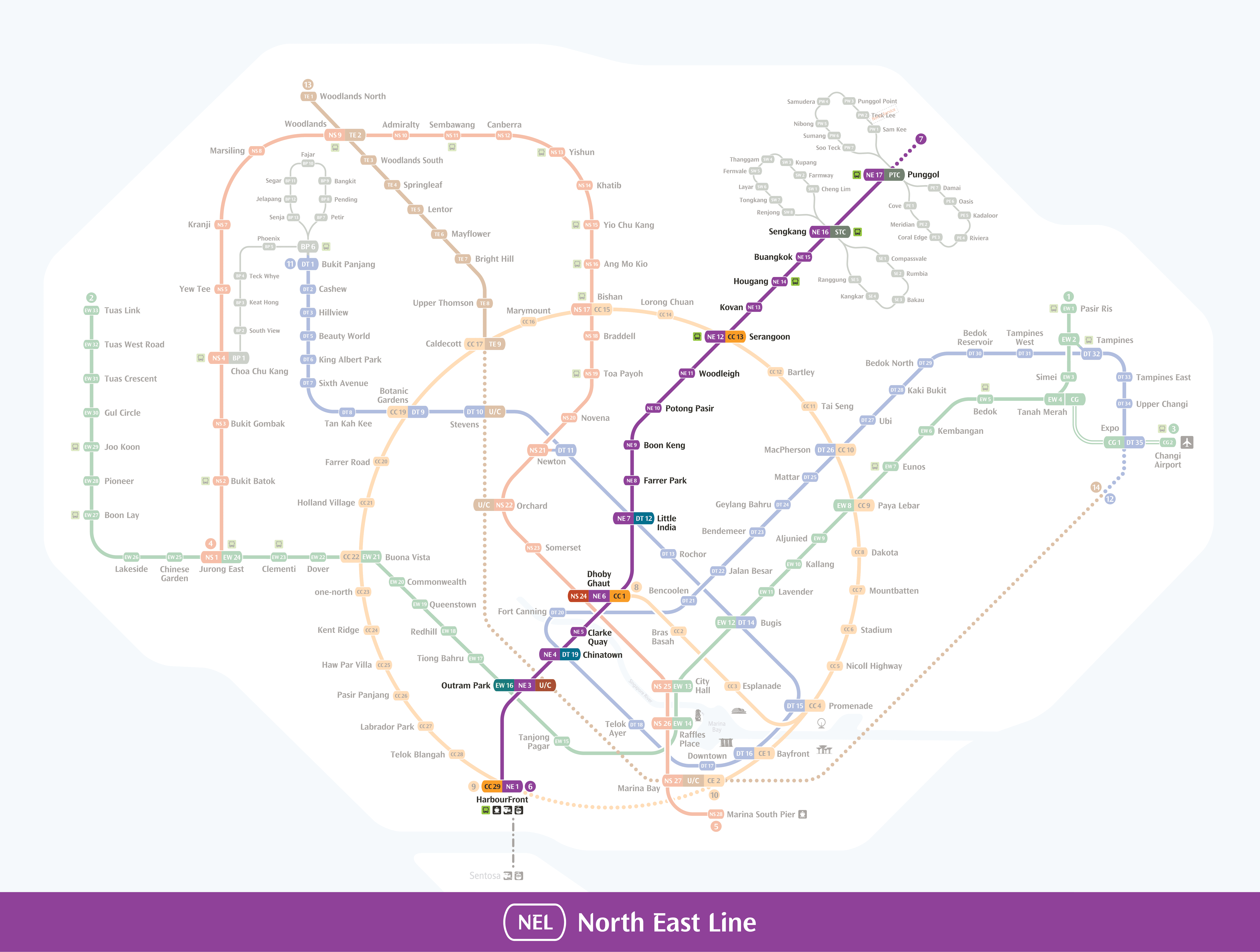 zoom_in
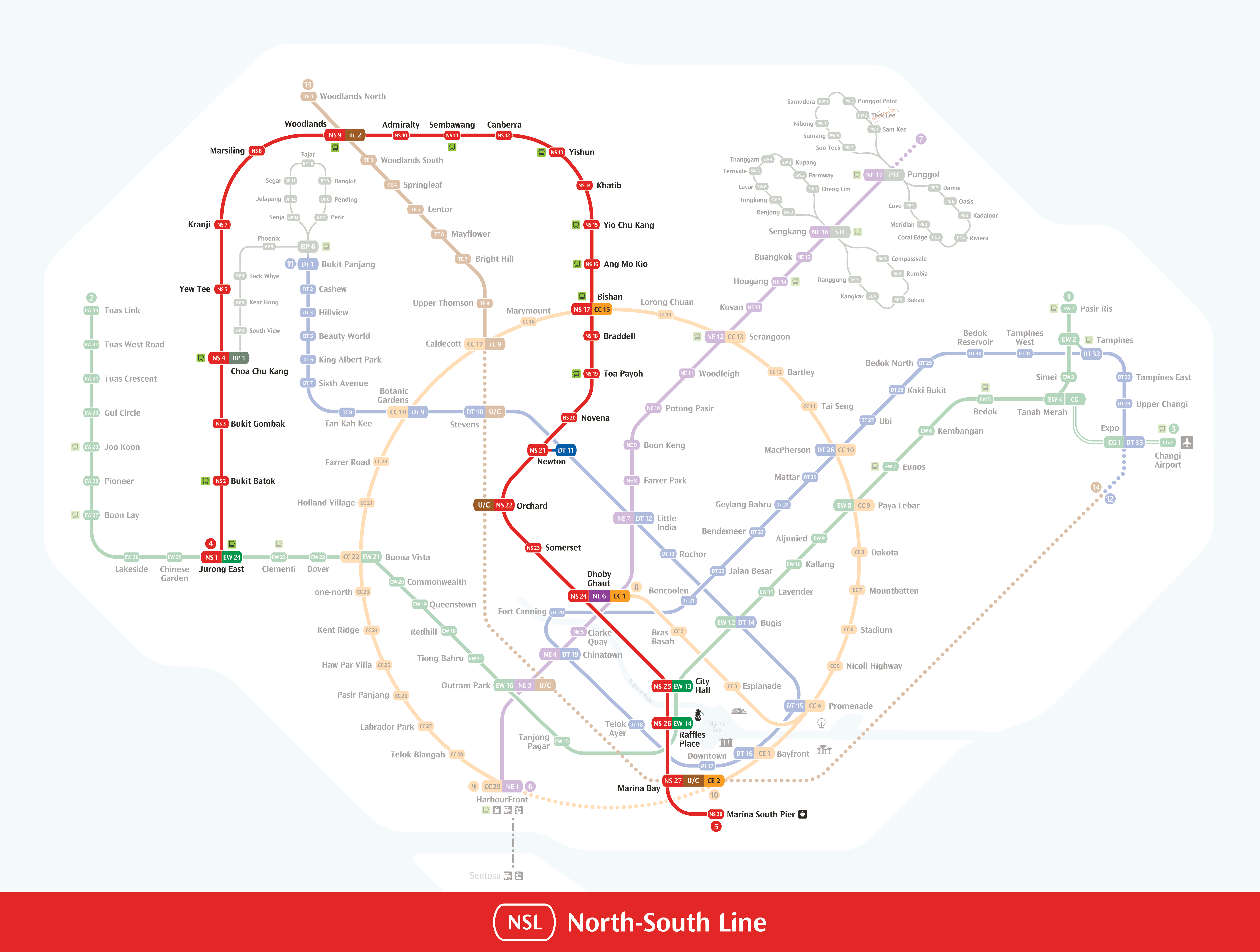 zoom_in
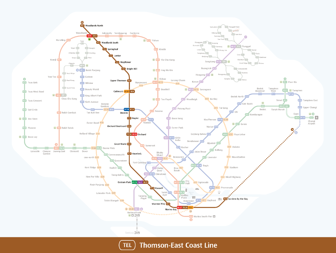 zoom_in
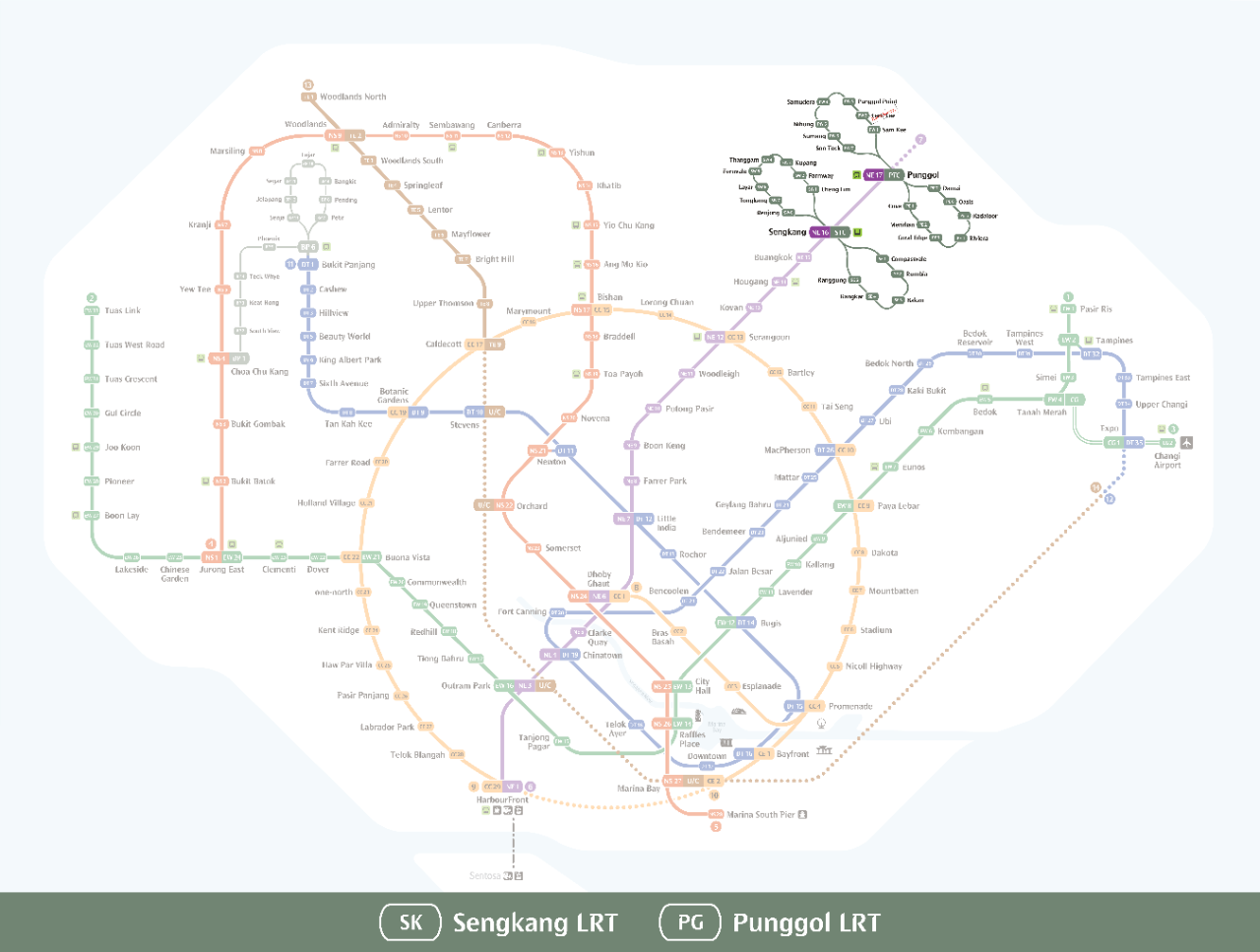 zoom_in
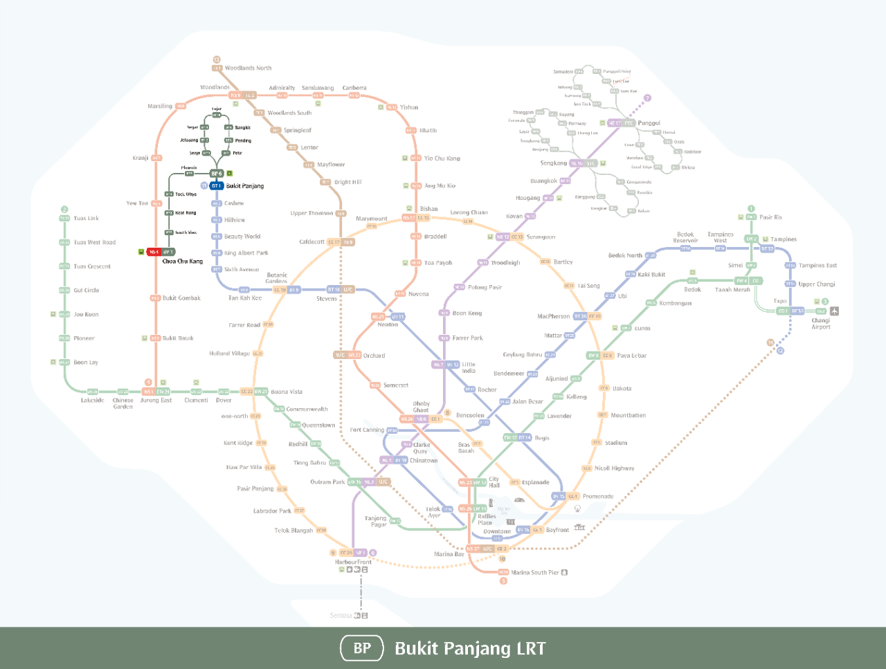 zoom_in
 zoom_in
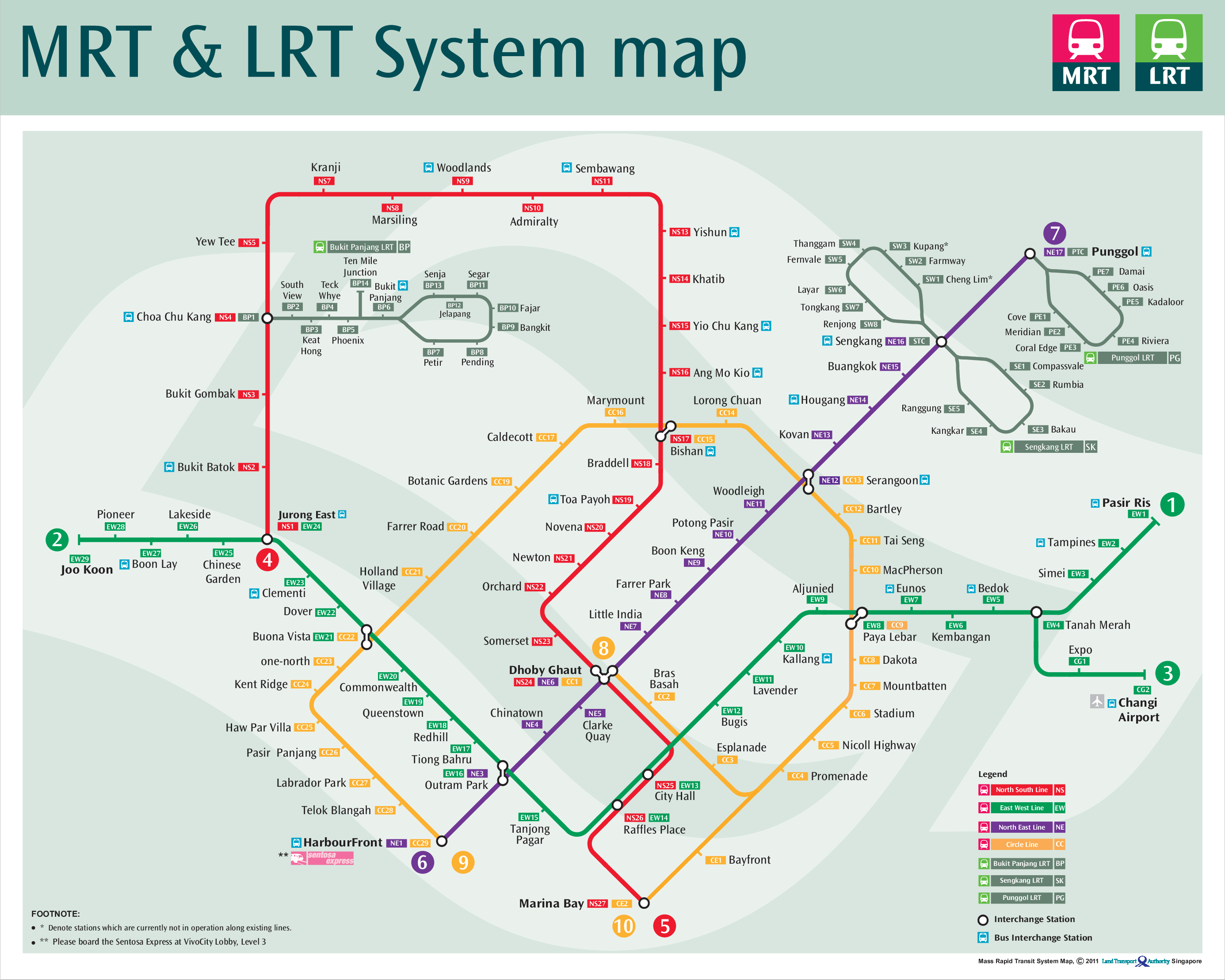 zoom_in
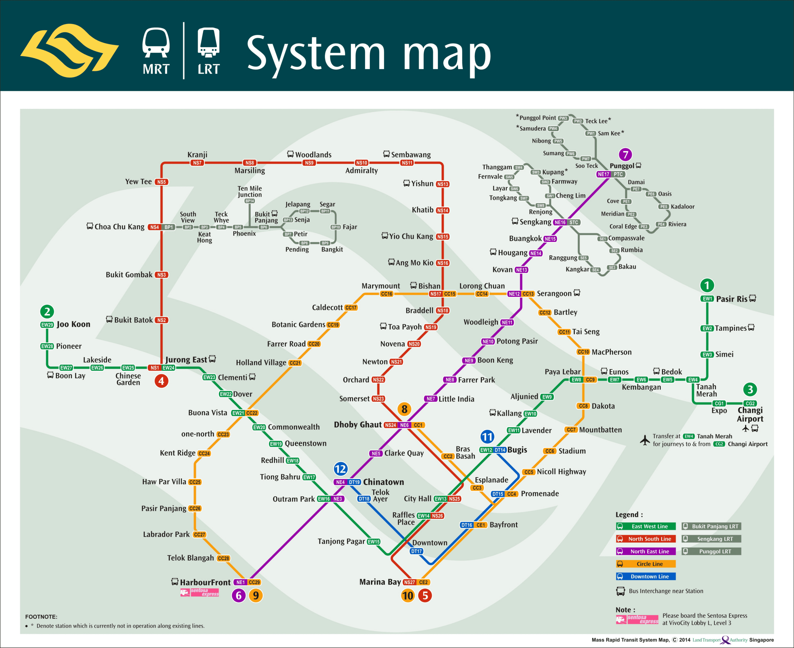 zoom_in
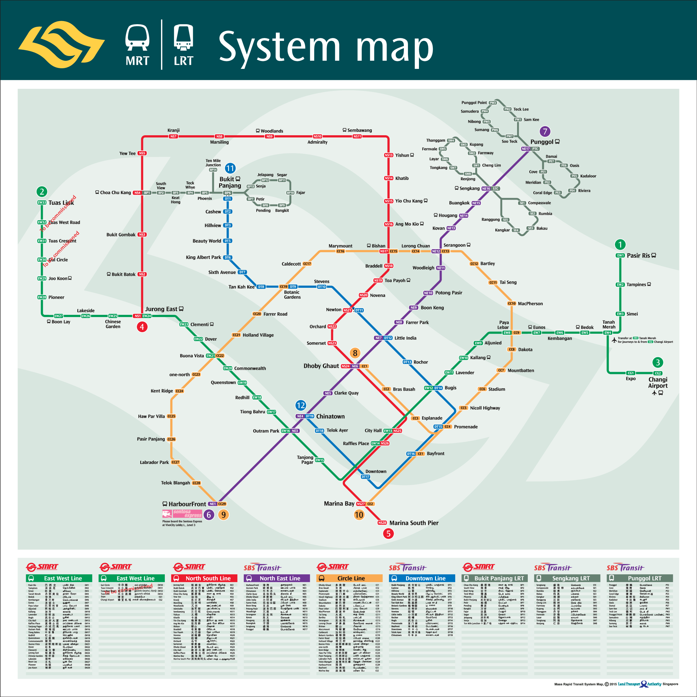 zoom_in
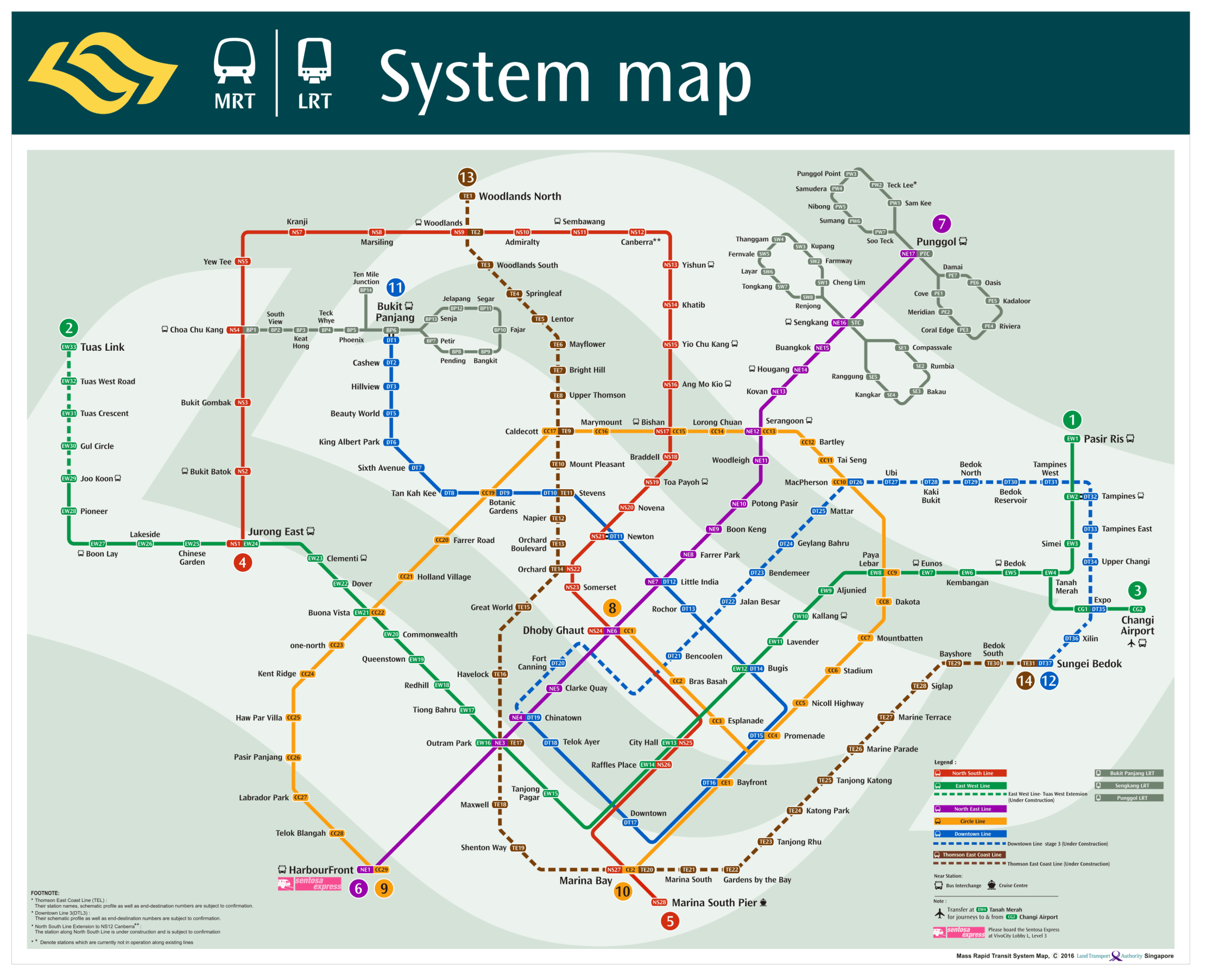 zoom_in
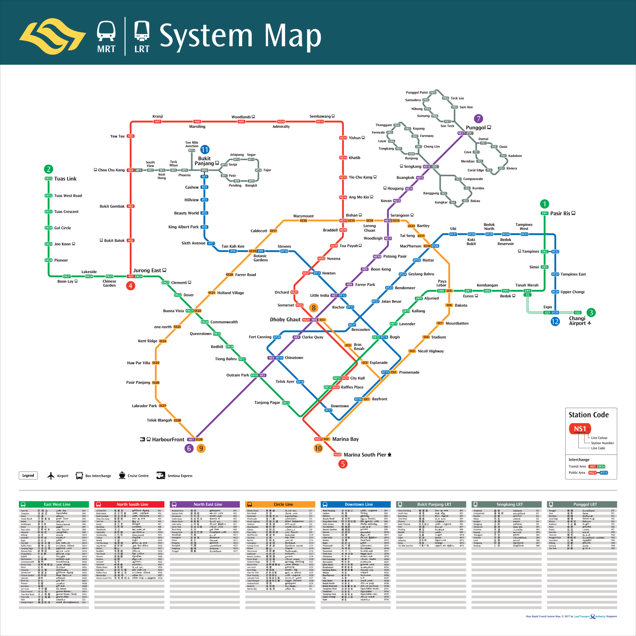 zoom_in
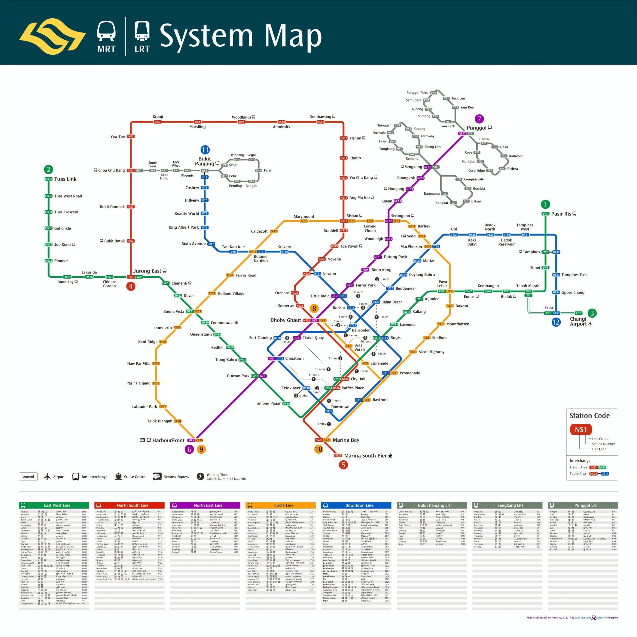 zoom_in
