
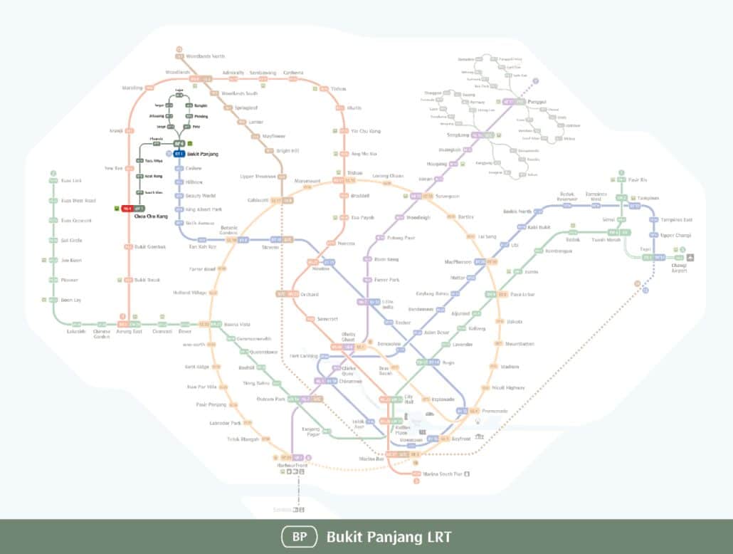
Full Bukit Panjang LRT guide: every station, interchange and the route in one place.
Singapore Bukit Panjang LRT Map
The Bukit Panjang Light Rail Transit (LRT) is a driverless automated rail network serving the Bukit Panjang new town in the north-west of Singapore. It links the residential heartlands to the wider public transport network, giving residents a quick way in and out of the estate without needing a car.
Getting around Singapore? Find any station on the interactive MRT map, or save the PDF map to use offline.
Introduction to the Bukit Panjang LRT Map
The Bukit Panjang LRT, commonly known as the BPLRT, opened in 1999 and is operated by SMRT. It was built to serve a large residential town that needed frequent, short-hop connections between homes, schools, and the shops at Bukit Panjang and Choa Chu Kang. The goal was simple: keep residents moving around the estate so fewer journeys require a car.
Evolution of the Bukit Panjang LRT
Planning for the BPLRT took the shape of the town seriously. The route was designed around where people actually live and where they need to go, connecting blocks of flats, schools, and neighbourhood centres in a loop-and-branch layout. That focus on everyday journeys is still what makes it useful today.
Design and Infrastructure
The BPLRT runs on elevated tracks throughout Bukit Panjang, keeping it clear of road traffic below. The raised alignment gives passengers open views over the town, making the ride a little more interesting than a bus on the same route. Stations are compact and practical, built to fit neatly into the existing streetscape.
Enhancing Local Connectivity
The network puts MRT stations and key amenities within easy reach of most addresses in the town. Residents can get to schools, neighbourhood malls, and community facilities without a long walk or a separate bus trip. That last-mile coverage is the main reason the line continues to see steady ridership.
Integration with Other Transit Modes
The BPLRT does not operate in isolation. It connects to the wider MRT and LRT network and to local bus services, so you can transfer between modes in a single journey. That connection to the rest of Singapore’s public transport system is what turns a short local hop into a practical option for longer trips across the island.
Comfort and Convenience
Every station on the Bukit Panjang LRT has air-conditioned platforms, digital display boards, and train arrival announcements. The LRT system is a practical choice for daily commuters in the Bukit Panjang area, with frequent services and sheltered access at most stops.
Sustainability and Green Initiatives
The Bukit Panjang LRT incorporates power management features aimed at reducing energy use. This fits into Singapore’s broader push to run public transport in a more environmentally responsible way.
Challenges Faced
The Bukit Panjang LRT has faced technical issues and service disruptions over the years, which have caused inconvenience for regular riders. These problems have driven ongoing maintenance and reliability improvement work on the system.
Expansion and Upgrades on the Bukit Panjang LRT Map
Plans to upgrade the Bukit Panjang LRT focus on improving reliability and capacity. Better integration with surrounding developments is also part of the longer-term picture for the network.
Looking Ahead
The Bukit Panjang LRT plays a genuine role in getting residents around the town and connecting them to the wider MRT network. With continued investment in reliability and upgrades, it remains a useful part of everyday life in Bukit Panjang.
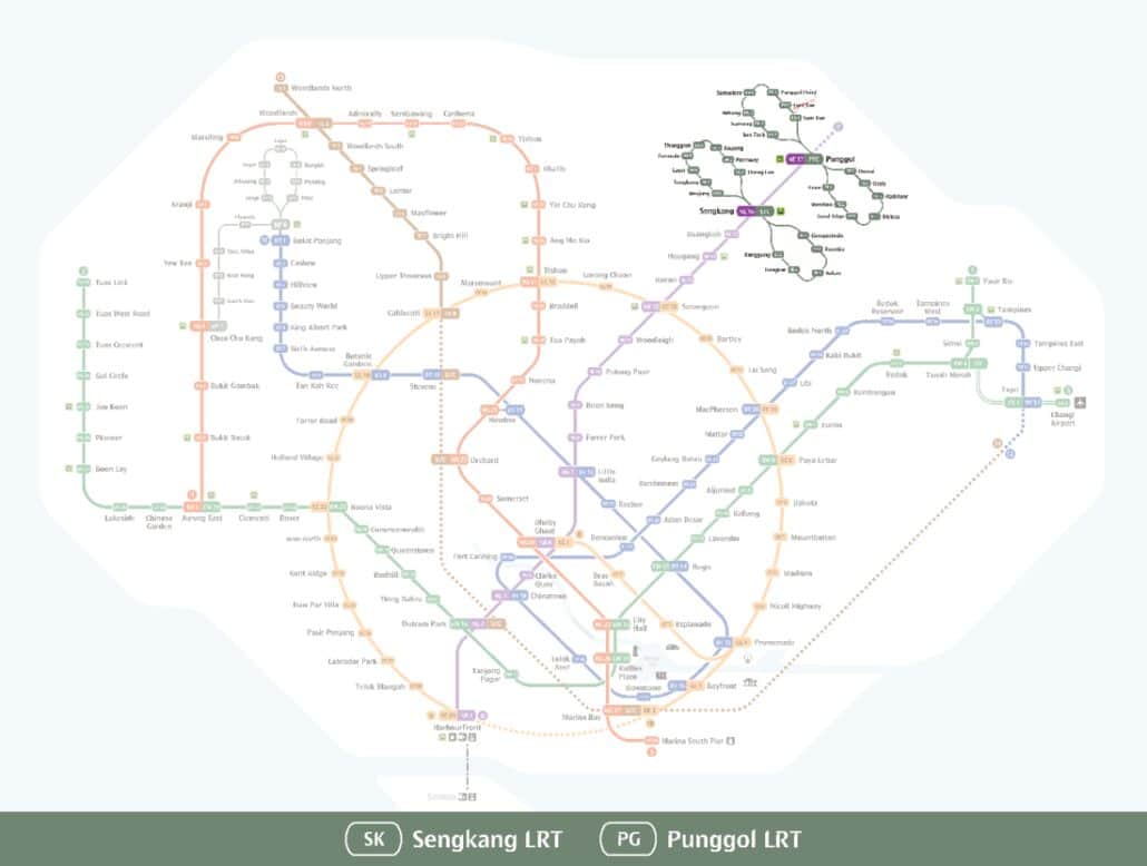
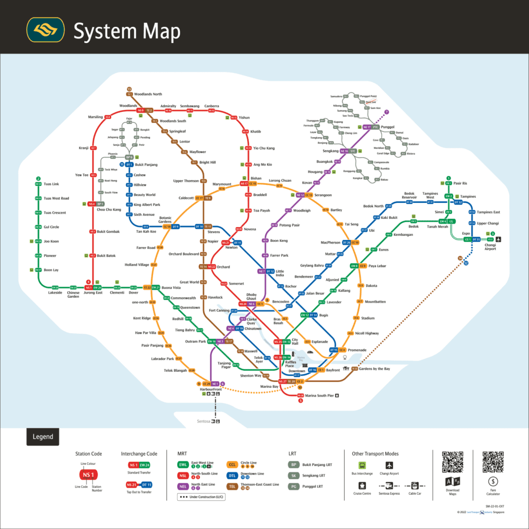
For the official version, see the LTA rail network map.