
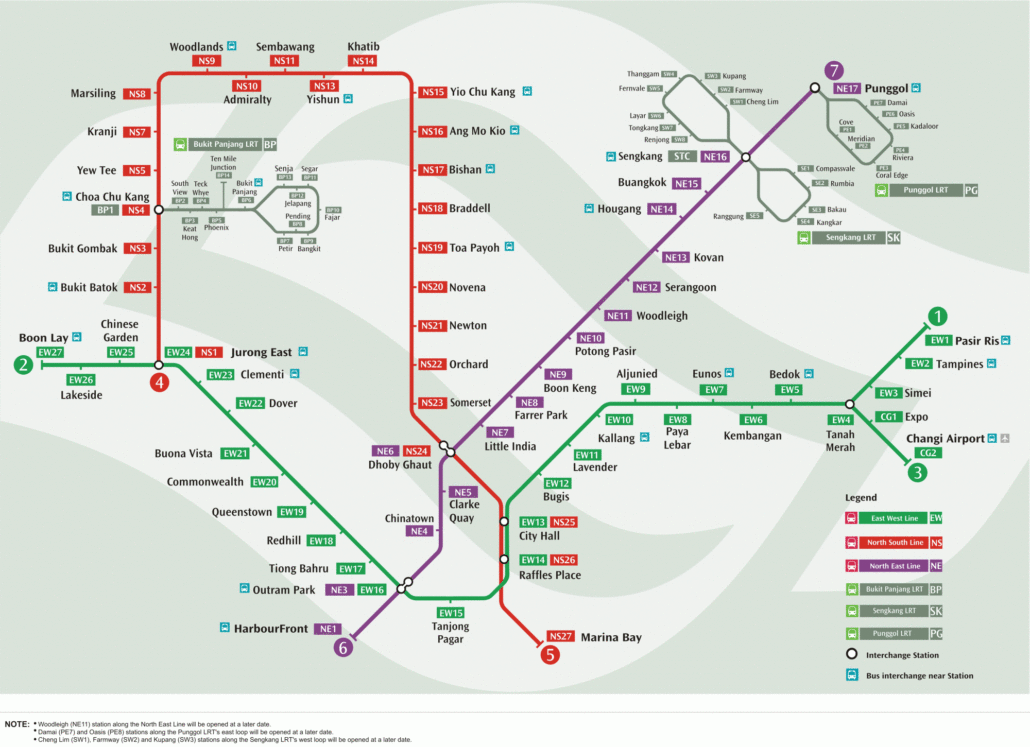
The MRT map 2006 edition is a useful snapshot of how the network looked before the big expansion years. At that point, only the North South Line, East West Line and North East Line were running. The Circle Line, Downtown Line and Thomson-East Coast Line were still years away.
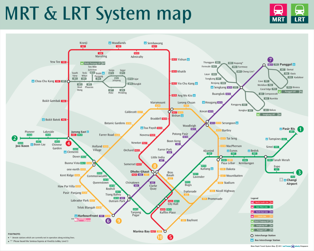
Looking at the 2006 map, you can see how much has changed. Stations that are now everyday commuter destinations simply did not exist yet, and the network covered far fewer parts of the island than it does today.
What the MRT map 2006 shows
In 2006 the network was small enough to fit on one tidy diagram. There were three MRT lines: the North South Line in red, the East West Line in green, and the North East Line in purple, which had opened in June 2003 as Singapore’s first driverless line, run by SBS Transit. The East West Line already had its short branch from Tanah Merah to Expo and Changi Airport, opened in 2001 and 2002. In the west it stopped at Boon Lay, and in the south the North South Line ended at Marina Bay.
Three light rail systems fed into the main lines: the Bukit Panjang LRT from Choa Chu Kang, and the Sengkang and Punggol LRT loops around the North East Line hubs. Parts of those loops were still unfinished, so several stations you use today were missing or marked as not yet open.
Getting around Singapore? Find any station on the interactive MRT map, or save the PDF map to use offline.
What came after
Almost everything else on the modern map arrived later. The Circle Line opened in stages from 2009, the Downtown Line from 2013 and the Thomson-East Coast Line from 2020. The East West Line was extended to Joo Koon and later Tuas Link, and the North South Line reached Marina South Pier in 2014. For the network as it runs today, use the current MRT map or download the 2026 MRT map PDF.
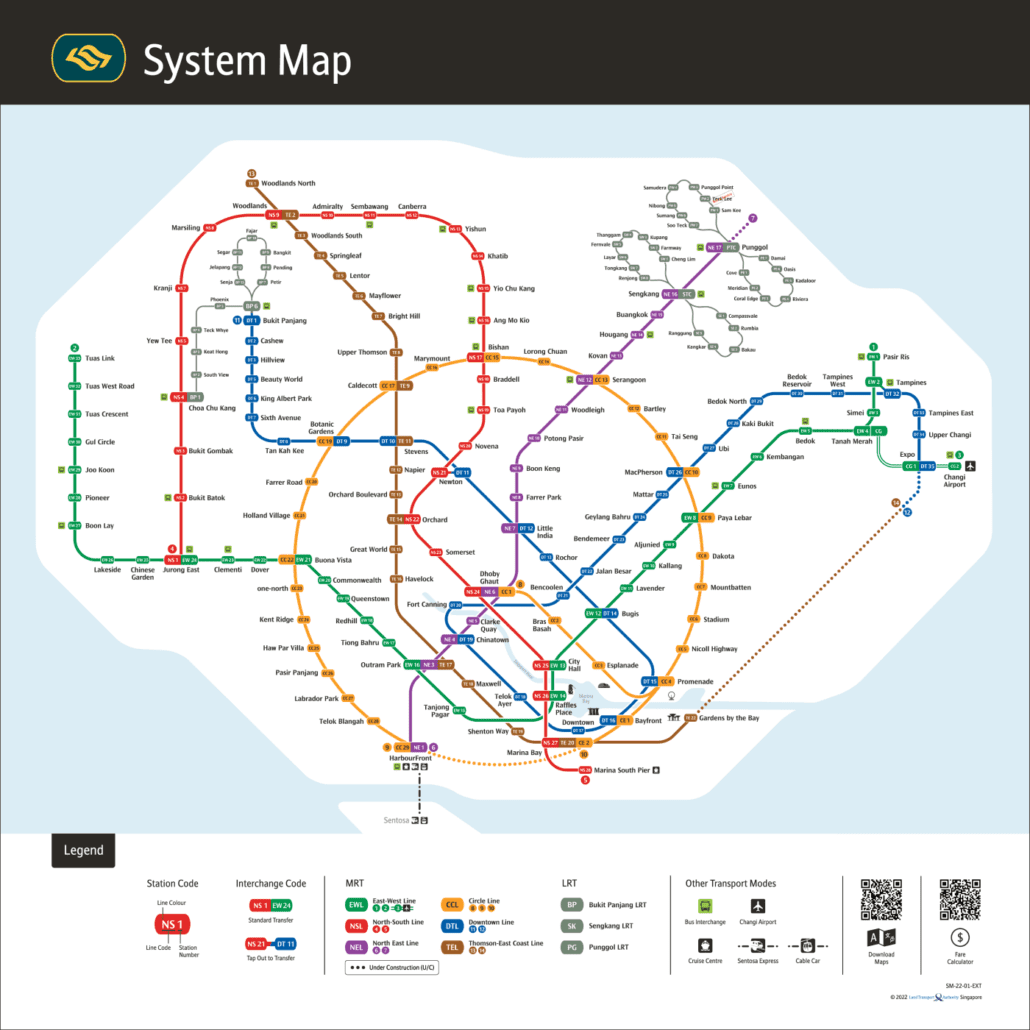
For the official version, see the LTA rail network map.