Last updated . Facts checked against LTA announcements.
Thomson-East Coast Line (Brown Line) MRT Map & Stations
The Thomson-East Coast Line is coloured brown on the network map, so most people just call it the brown line. It is the newest MRT line in Singapore and runs underground the whole way, from Woodlands in the north, down through Orchard and Marina Bay, and out east along the coast. If you have ever had to zigzag across the island to get from the north to the east, this is the line that finally makes that trip a straight shot.
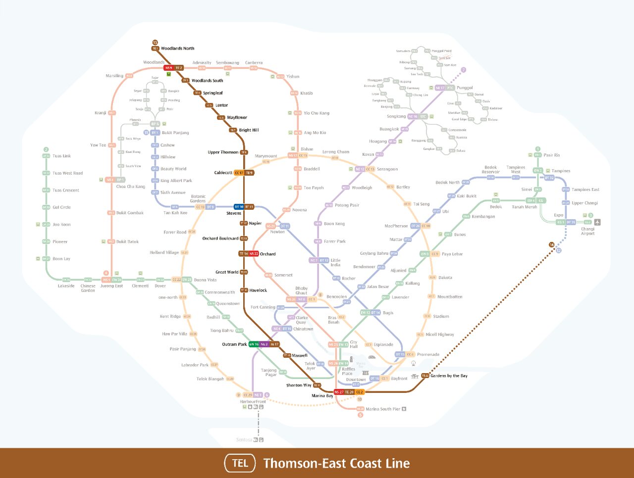
Thomson-East Coast Line (brown line) map. For searching and highlighting MRT stations or lines on the map we recommend to use our interactive MRT map.
The brown line traces a long "L" shape across Singapore. It starts up north near the Causeway, runs straight down through the central shopping and business belt past Orchard, the CBD and Marina Bay, then curves east to follow the coastline through Marine Parade and Bedok. That single sweep ties together three parts of the island that previously required at least one awkward transfer.
Quick facts about the TEL
Map colour: Brown (so "brown line" and "TEL" mean the same thing)
Line code: TE
Type: Fully underground, driverless, operated by SMRT
Length when complete: About 43 km, 32 stations
Northern end: Woodlands North (TE1), also the future link to the Johor Bahru RTS
Opened in stages: 2020, 2021, 2022 and 2024, with the final eastern stretch due in the second half of 2026
Full list of Thomson-East Coast Line stations
Here is every station on the line, north to south and then east, with its station code and the lines you can transfer to.
Code
Station
Interchange / transfer
TE1
Woodlands North
Future RTS Link to Johor Bahru
TE2
Woodlands
North-South Line (NS9)
TE3
Woodlands South
–
TE4
Springleaf
–
TE5
Lentor
–
TE6
Mayflower
–
TE7
Bright Hill
–
TE8
Upper Thomson
–
TE9
Caldecott
Circle Line (CC17)
TE11
Stevens
Downtown Line (DT10)
TE12
Napier
–
TE13
Orchard Boulevard
–
TE14
Orchard
North-South Line (NS22)
TE15
Great World
–
TE16
Havelock
–
TE17
Outram Park
East-West Line (EW16) & North East Line (NE3)
TE18
Maxwell
–
TE19
Shenton Way
–
TE20
Marina Bay
North-South Line (NS27) & Circle Line (CE2)
TE22
Gardens by the Bay
–
TE23
Tanjong Rhu
–
TE24
Katong Park
–
TE25
Tanjong Katong
–
TE26
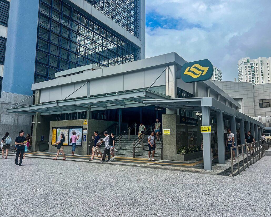
Marine Parade
–
TE27
Marine Terrace
–
TE28
Siglap
–
TE29
Bayshore
–
Three stations are built but not yet open: TE10 Mount Pleasant, TE21 Marina South and TE22A Founders' Memorial. Trains pass through without stopping. The final two eastern stations, TE30 Bedok South and TE31 Sungei Bedok, are due in the second half of 2026.
Thomson-East Coast Line: getting around
The brown line runs straight through parts of the island that used to mean roundabout journeys with transfers. Whether you are heading from the north into town, or from the city out to the East Coast, many trips become shorter and more direct once you start using it regularly.
Key Takeaways
The Thomson-East Coast Line (TEL) is Singapore's sixth MRT line, coloured brown on the network map and commonly called the "brown line."
It connects the north of the island to the city centre and the east coast, with interchange stations linking it to every other MRT line.
The line is fully underground and driverless, operated by SMRT, running from Woodlands North to Bayshore on the eastern coast (with one more stage still to open).
Features like regenerative braking and energy-efficient trains make it one of the more sustainable ways to get around Singapore.
Step-free access, lifts and tactile guidance at every station make the TEL straightforward to use for commuters of all abilities.
Exploring the Thomson-East Coast Line
The Thomson-East Coast Line (TEL) is the sixth line on Singapore's MRT network and the most recent to open in stages. Built and run by SMRT under the Land Transport Authority (LTA), it connects neighbourhoods that were previously awkward to reach without doubling back or changing lines multiple times. For commuters in the east especially, it provides the first direct rail link into town.
Route and Stations
The TEL runs about 43 kilometres and will have 32 stations once fully open. It links the north of Singapore to the east coast, passing through the central shopping and business districts along the way, so it works equally well for daily commuters and visitors. The line starts at Woodlands North, near the Causeway, heads south through the Thomson area, and then curves east along the coast. Current southern terminus is Bayshore (TE29), with Bedok South and Sungei Bedok due to open in the second half of 2026 to complete the line.
Where the brown line connects to other MRT lines
The TEL connects to every other MRT line on the network through interchange stations, which cuts down on long detours. Here is where you can switch lines:
Outram Park (TE17) to the East West Line and North East Line
Marina Bay (TE20) to the North South Line and Circle Line
Looking further ahead, the northern terminus at Woodlands North will connect to the upcoming Johor Bahru-Singapore Rapid Transit System (RTS) Link. In the 2030s the line is also planned to extend to Changi Airport, taking over the Changi branch from the East West Line.
Sustainable design on the Thomson-East Coast Line
The Thomson-East Coast Line was built with energy-efficient technologies and green building practices, with the aim of keeping its carbon footprint as low as possible. That focus on sustainability runs through the stations and infrastructure along the entire route.
The TEL is fully automated and driverless, which allows trains to run frequently and consistently throughout the day. During peak hours you can expect short waits between services, making your commute more predictable. The line generally runs from around 5.30am to midnight, with a slightly later start on Sundays and public holidays.
With the final stages still to open, including Bedok South (TE30) and Sungei Bedok (TE31) due in the second half of 2026, the line will only become more useful over time. For now, the TEL already offers a fast, reliable alternative to driving for a large stretch of the island.
East West Line integration at Outram Park
The Thomson-East Coast Line connects to the East West Line at Outram Park (TE17), one of the more practical interchanges on the network. You also pick up the North East Line there, so a single stop gives you access to three lines at once.
For daily commuters, that link reduces the number of transfers needed across a journey. Whether you are heading to the city centre, a neighbourhood further west, or anywhere along the East Coast, Outram Park brings the lines together into one straightforward trip.
Benefits of East-West Line integration
Wider reach: Easy transfers between the two lines let you get to more destinations without going back the way you came, from the city centre out to residential areas and shopping districts.
More route options: Having two lines available at Outram Park gives you alternative paths when one route is disrupted or slower.
Shorter travel times: The direct link cuts down on backtracking and unnecessary transfers, which keeps commutes quicker.
Straightforward interchange: Outram Park has clear signage between platforms, so changing between the Thomson-East Coast and East-West lines is simple even if you are unfamiliar with the station.
Thomson East Coast Line
East-West Line
Opening Year
2020 (opened in stages through 2026)
Number of Stations
32 (when fully complete)
Train Frequency
Every 2-3 minutes at peak
Travel Time
End to end: around 60 to 65 minutes
Interchange with the East-West Line:
Outram Park (TE17 / EW16)
How the line opened, stage by stage
The Thomson-East Coast Line opened in stages, with each phase adding new stations and extending the line's reach. Here is how the line came together and what is still to come.
Stage 4 (opened 23 June 2024)
Tanjong Rhu (TE23)
Katong Park (TE24)
Tanjong Katong (TE25)
Marine Parade (TE26)
Marine Terrace (TE27)
Siglap (TE28)
Bayshore (TE29)
Stage 5 (due second half of 2026)
Bedok South (TE30)
Sungei Bedok (TE31)
Stage 5 has not opened yet as of mid-2026. Three further stations, Mount Pleasant (TE10), Marina South (TE21) and Founders' Memorial (TE22A), are already built but remain closed. Trains pass through without stopping while the surrounding developments catch up. Further ahead, the line is expected to extend towards Changi Airport in the 2030s.
Services
The TEL improves connectivity across the northern, central and eastern parts of Singapore.
It gives commuters an alternative to the North-South Line and the East West Line, reducing pressure on both of those busier routes.
Key destinations served include the Central Business District, Marina Bay and East Coast Park.
Once the Changi Airport extension opens, the TEL will also give travellers a direct rail link to the terminals.
Thomson East Coast Line: Sustainability
The Thomson-East Coast Line was designed with energy efficiency in mind. For commuters, that mostly means a reliable, modern ride. Behind the scenes, it means a system built to use less power and produce fewer emissions than older lines.
Energy Efficiency and Reduction of Emissions
The trains use regenerative braking, which recovers energy during braking and converts it back into electricity rather than losing it as heat. That reduces overall power consumption compared with older braking systems. Modern energy-management systems also help balance load across the network.
Green Spaces and Eco-Friendly Design
Greenery and landscaping around TEL stations do more than look good. Planting provides shade, helps reduce the urban heat island effect and improves air quality for people passing through.
The Thomson-East Coast Line reflects Singapore's broader approach of integrating transport infrastructure with environmental goals, keeping green space part of the picture rather than an afterthought.
Bringing natural elements into station design aligns with Singapore's long-standing commitment to balancing urban development with conservation. It is a practical as much as an aesthetic choice.
Multimodal Transport Connections
The TEL is built to work alongside other transport options, making it straightforward to combine modes on a single journey. You can walk or cycle to a station, take the train across town, then catch a bus for the last stretch. This kind of flexibility helps reduce car use and takes pressure off the roads.
Environmental Benefits of the Thomson East Coast Line
Initiatives
Reduced energy consumption
Regenerative braking system
Decreased carbon emissions
Energy-efficient trains
Preservation of green spaces
Landscaping and urban greening
Promotion of multimodal transportation
Integrated transport connections
Accessibility and Inclusivity
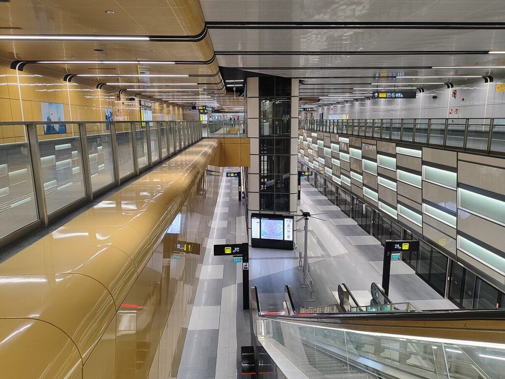
Accessibility was built into the Thomson-East Coast Line from the start, not added later. Every station is designed so that people of all abilities can use it comfortably.
Barrier-free facilities are standard at every station, including ramps, lifts and tactile guidance strips. These help wheelchair users, older commuters, families with prams and anyone who finds stairs difficult. Tactile paving and Braille signage also assist passengers with visual impairments, guiding them safely through the station and to the platform edge.
Features for Diverse Needs
Priority seating: Reserved seats for elderly passengers, pregnant women and persons with disabilities.
Accessible toilets: Spacious toilets suitable for passengers with disabilities at every station.
Help points and assistance hotlines: Passengers who need support can reach help quickly through in-station help points and emergency assistance lines.
Tips for Travelling on the Thomson-East Coast Line
A few simple habits make journeys on the Thomson-East Coast Line quicker and more comfortable, whether you ride it daily or are planning your first trip.
Plan your route before you leave. Check the TEL map, note your boarding and alighting stations, and work out which interchanges you need if you are changing lines.
Travel off-peak where you can. The line gets busy during morning and evening rush hours. Shifting your trip by even half an hour can make a real difference to comfort.
Use a journey planning app. Apps such as MyTransport.SG and Citymapper show real-time train timings, suggest which exit to use, and flag disruptions before they affect your trip.
Make use of the interchange stations. The TEL connects to several other lines, so follow the in-station signage to find the right platform and keep your journey direct.
Give up priority seats when needed. Reserved seats are for elderly passengers, pregnant women and those with disabilities, as on all MRT lines in Singapore. Be ready to offer yours if someone needs it.
Pay by contactless card or SimplyGo. Tap in with an EZ-Link card, a contactless bank card or a mobile wallet. Top up before you travel to avoid holding up the queue.
Check for service updates. SMRT posts alerts about disruptions on its website and social media channels, so a quick check before you set off can save you time.
Follow basic platform etiquette. Queue at the marked doors, let passengers off the train first, and keep the aisles clear.
Future Expansion Plans
The Thomson-East Coast Line is still growing. The next step is the opening of Bedok South (TE30) and Sungei Bedok (TE31), due in the second half of 2026, which will complete the current eastern stretch of the route.
Further ahead, the line is planned to absorb the Changi Airport branch currently served by the East West Line, giving travellers a direct rail connection between the airport and destinations across Singapore. At the northern end, Woodlands North will link to the Johor Bahru-Singapore RTS, opening up cross-border travel.
The east coast extension brings rail access to neighbourhoods like Bedok South that previously had no MRT station, something residents there have waited a long time for. You can also explore the connecting LRT lines to see how the wider rail network reaches into the heartlands.
Upcoming TEL Stations and Extensions
Bedok South (TE30) and Sungei Bedok (TE31): Due in the second half of 2026, these two stations will complete the line's current eastern run and bring rail access to parts of Bedok that have long been without it.
Bayshore (TE29): Already open, this station sits close to East Coast Park and has improved access to the surrounding residential areas in the east.
Woodlands North (TE1): At the northern end of the line, this station will serve as the link to the future Johor Bahru-Singapore RTS for cross-border travel.
The Thomson-East Coast Line has changed how many Singaporeans get around. Its long reach across the island and well-placed interchanges give commuters more options and reduce the need to change trains multiple times.
Improved connectivity and accessibility
One of the line's biggest strengths is the number of interchanges it offers, connecting to lines such as the East West Line, North South Line and Downtown Line at various points along the route. You can see how it fits into the broader network on the full MRT lines overview.
Reduced congestion and travel time
The Thomson-East Coast Line gives people a fast rail alternative that takes pressure off Singapore's roads. For many trips it is now quicker to take the train than to drive, which encourages more commuters to leave the car at home and supports a shift towards greener travel. Stations make it straightforward to switch between rail, bus and other modes, so end-to-end journeys work better overall.
Economic and urban development benefits
The Thomson-East Coast Line brings wider benefits to Singapore's economy. Building and running a line of this scale creates jobs across construction, engineering and operations. New MRT stations tend to attract development nearby, from shops and offices to homes and public spaces, helping create more connected neighbourhoods across the city.
What is it actually like to ride?
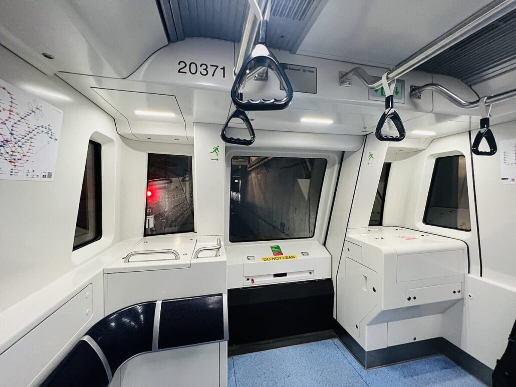
The trains are driverless and run roughly every few minutes during normal hours, with service from about 5.30am to past midnight. Because the whole line is underground, you get the same air-conditioned, weather-proof ride end to end, which is a real advantage during a downpour or the midday heat. Travelling the full length of the line takes a bit over an hour, but most people are only riding a handful of stops. Signage leans on colour and pictures rather than walls of text, so following the brown markers to your platform is genuinely easy.
Summary
The Thomson-East Coast Line has reshaped what is possible on Singapore's transport network, offering a direct, fully underground link between the north, the city centre and the east coast. With stations opening in stages from 2020 through to 2026, it connects neighbourhoods, business districts and popular destinations across the island. The brown line gives you a dependable, time-saving way to get around, whether you are commuting, visiting friends or exploring somewhere new. Use the Thomson-East Coast Line map above to plan your route, and check the full Singapore MRT map for everything else on the network.
Station guides on this line
Codes, transfers, next stations, train times and a map link for each station.
Is the brown line the same as the Thomson-East Coast Line?
Yes. The Thomson-East Coast Line (TEL) is shown in brown on the MRT map, so "brown line" and "TEL" refer to exactly the same line.
How many stations are on the Thomson-East Coast Line?
The line will have 32 stations along about 43 km when fully complete. Stage 5 (Bedok South TE30 and Sungei Bedok TE31) is due in the second half of 2026, so most stations are already open.
Where does the Thomson-East Coast Line start and end?
It runs from Woodlands North (TE1) in the north, down through the city centre, then east along the coast. Once Stage 5 opens, the eastern terminus will be Sungei Bedok (TE31).
Which lines can I transfer to from the TEL?
You can interchange to the North-South, East-West, North East, Circle and Downtown lines at stations including Woodlands, Caldecott, Stevens, Orchard, Outram Park and Marina Bay.
Is the Thomson-East Coast Line fully underground?
Yes. The entire line runs underground and is driverless, so every journey is air-conditioned and sheltered from the weather.
Want the whole route on one page? Open the Thomson-East Coast Line map to see every station and interchange along the line.