
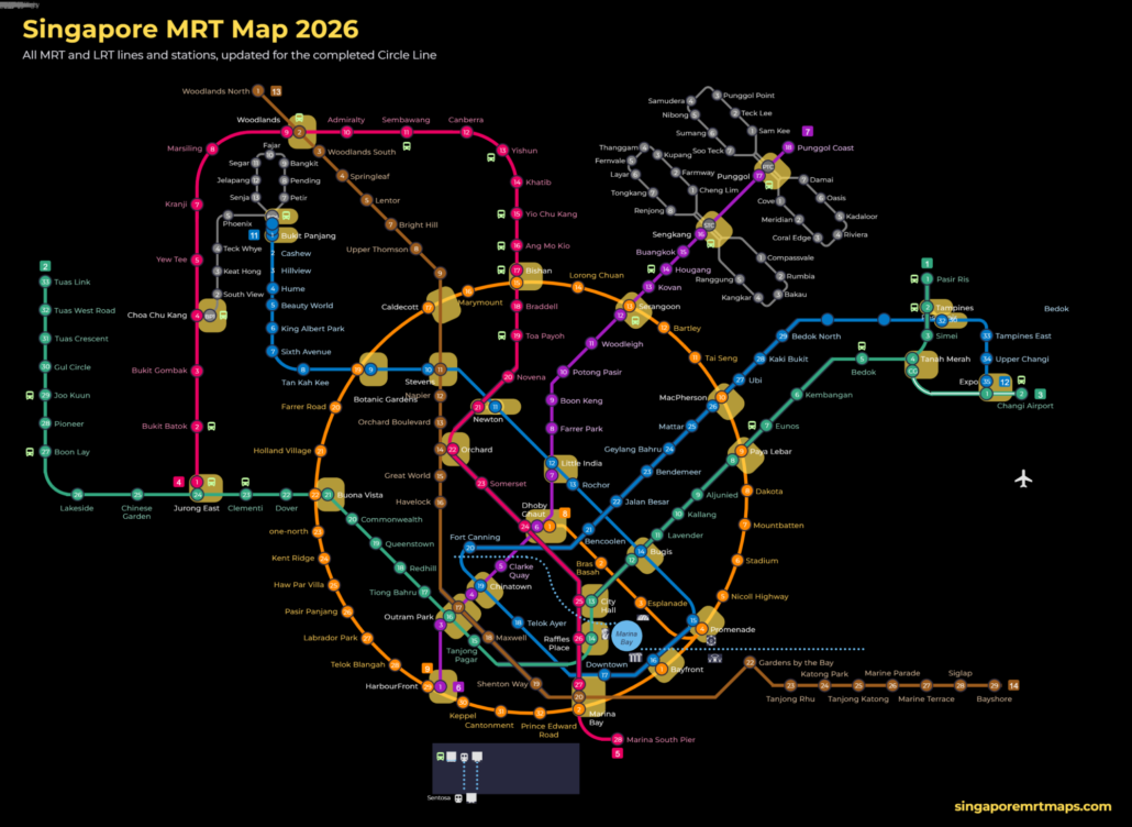
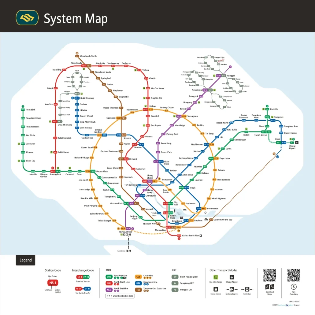
シンガポールMRT(Mass Rapid Transit)の2026年版路線図を日本語で解説します。MRTは6路線、LRT(軽量高架鉄道)は3路線、駅は合わせて180以上。チャンギ空港、オーチャード、マリーナベイ、セントーサ島の玄関口ハーバーフロントまで、観光の主要スポットはほぼすべて駅から徒歩圏内です。上の路線図は英語表記ですが、駅名の読み方と路線の見方をこのページで確認すれば迷いません。拡大できるインタラクティブ版と、オフライン用のPDF版路線図(無料)もあります。 路線図の見方 シンガポールのMRTは路線ごとに色が決まっていて、駅には「NS24」「EW13」のようなコードが付いています。アルファベットが路線、数字が駅の順番です。乗換駅は複数のコードを持ち、路線図では白い丸でつながって表示されます。車内アナウンスと駅の案内板は英語・中国語・マレー語・タミル語の4言語で、日本語はありませんが、コードさえ覚えておけば行き先の確認は簡単です。 MRT・LRT全路線一覧(2026年) 路線 色 コード 区間 主な観光スポット 南北線(North South Line) 赤 NS ジュロンイースト〜マリーナサウスピア オーチャード、シティホール、マリーナベイ 東西線(East West Line) 緑 EW / CG パシルリス〜トゥアスリンク、チャンギ空港支線 チャンギ空港、ブギス、ラッフルズプレイス 北東線(North East Line) 紫 NE ハーバーフロント〜プンゴルコースト ハーバーフロント(セントーサ)、チャイナタウン、リトルインディア サークル線(Circle Line) 橙(黄) CC / CE 環状線(2026年7月に全線開通) ベイフロント、エスプラネード、ホーランドビレッジ ダウンタウン線(Downtown Line) 青 DT ブキパンジャン〜エキスポ ベイフロント(マリーナベイ・サンズ)、ブギス、チャイナタウン トムソン・イーストコースト線(Thomson-East Coast Line) 茶 TE ウッドランズノース〜ベイショア オーチャード、ガーデンズ・バイ・ザ・ベイ、マリーナベイ […]
Category Archives: Maps

Blog
Woodlands MRT Smokers Leave Butts: What Riders Can Do
The Independent Singapore reported on 13 October 2026 that smokers gathering near Woodlands MRT leave [...]
Continue readingOct

Blog
Autonomous bus trials halted: what LTA is testing instead
The Land Transport Authority has called off plans to deploy six driverless buses on two [...]
Continue readingOct
Blog
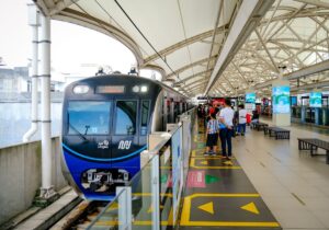
Straits Times audio news now at 68 SMRT stations
The Straits Times has launched audio news bulletins at 68 SMRT-operated stations, giving commuters a [...]
Continue readingOct
Blog
Commuter Fatigue and the North-South Corridor Delay
Delays to the North-South Corridor have stretched a years-long adjustment for residents and commuters. Here [...]
Continue readingOct
Blog
Singapore MRT line colours: every line by colour
Red, green, purple, yellow, blue, brown and grey: what each Singapore MRT line colour means, [...]
Continue readingOct
Jan
Singapore MRT Map PDF 2026 Download Updated for 2026: the PDF is the official Land Transport Authority system map, version dated 21 July 2026. It includes the completed Circle Line loop (Keppel, Cantonment and Prince Edward Road), Hume on the Downtown Line, Punggol Coast on the North East Line, and the Thomson-East Coast Line through […]
Aug
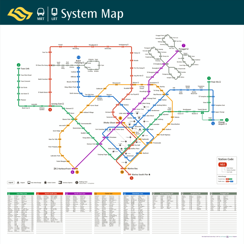
The MRT Walking Map (2017) is a practical tool for getting around Singapore’s extensive rail network on foot. Unlike a standard route map, it helps you see which stations are close enough to walk between, which is genuinely useful given how densely connected the MRT is across the city. MRT & Walkable Map (2017) The […]

Aug
This is the MRT map 2017 edition, an illustrated guide to getting around Singapore by rail. The map uses colour-coded lines to help you find your way between neighbourhoods, whether you are heading to Orchard Road for shopping or Botanic Gardens for a quieter afternoon. Each station is clearly marked, so planning your journey is […]

Aug
A Snapshot of Singapore’s MRT Network in 2016 The MRT map 2016 edition captures the network at a particular moment of growth, before several major expansions changed the shape of the system. Looking back at it now, you can see clearly how much has changed since then. By 2016, the network already spanned the island […]
Aug
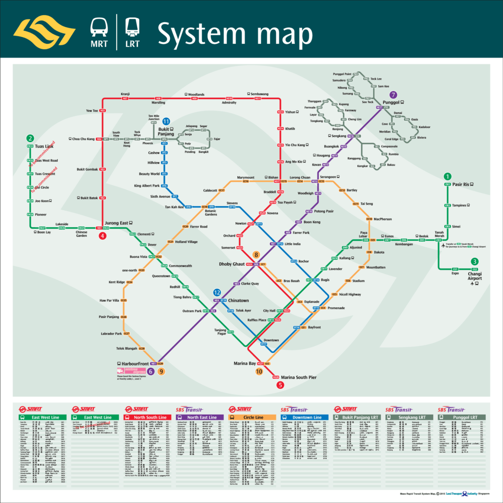
The MRT map 2015 edition shows the Singapore rail network as it stood that year, before several major extensions and new lines were added. It is a useful reference if you want to see how the system looked at that point in time. Singapore‘s MRT has grown considerably since 2015, with the Downtown Line, Thomson-East […]
Aug
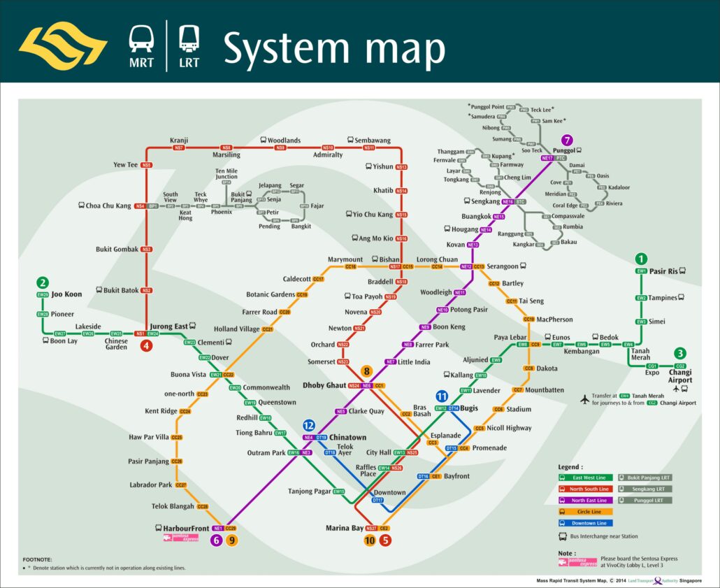
The MRT map 2014 edition captures the network at a telling point in its growth. New lines and stations were coming online, pushing rail coverage from established urban centres out into newer residential towns. It is a useful historical reference if you want to see how far the network has come since then. The map […]
Aug
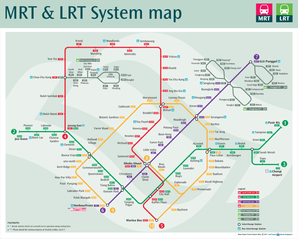
This page shows the MRT map 2011 edition, as the network looked that year. It is a useful reference for seeing how the network stood at that point, before several major expansions changed the picture. Use it to compare how far the system has come, or simply to understand the layout of the core lines. […]
Aug
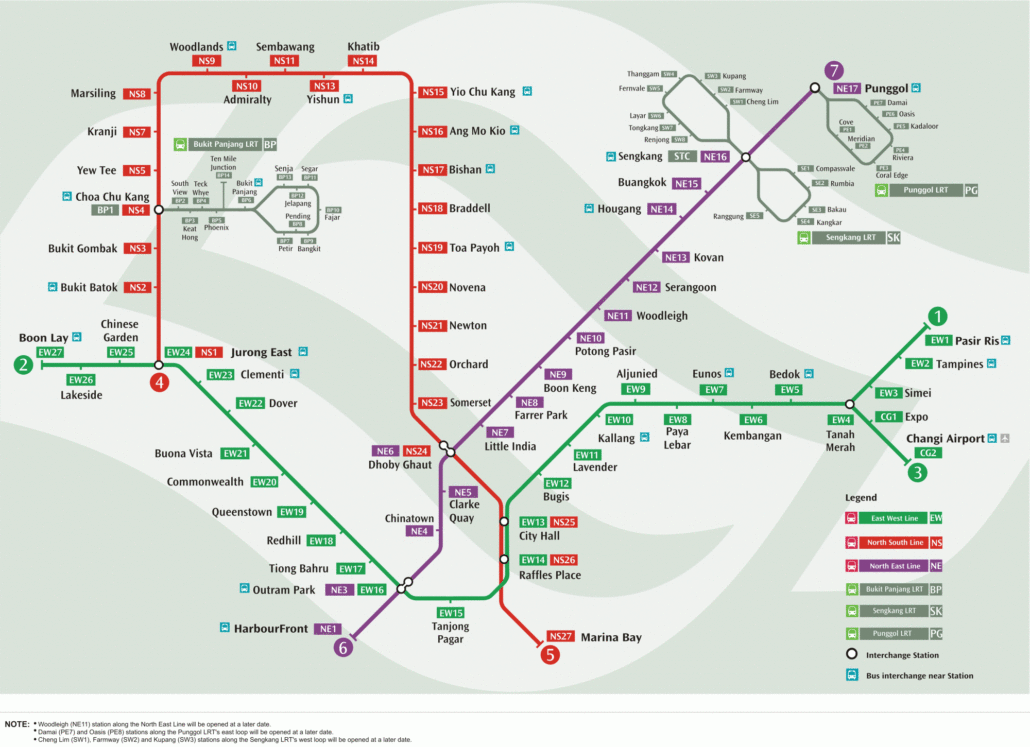
The MRT map 2006 edition is a useful snapshot of how the network looked before the big expansion years. At that point, only the North South Line, East West Line and North East Line were running. The Circle Line, Downtown Line and Thomson-East Coast Line were still years away. Looking at the 2006 map, you […]
Aug
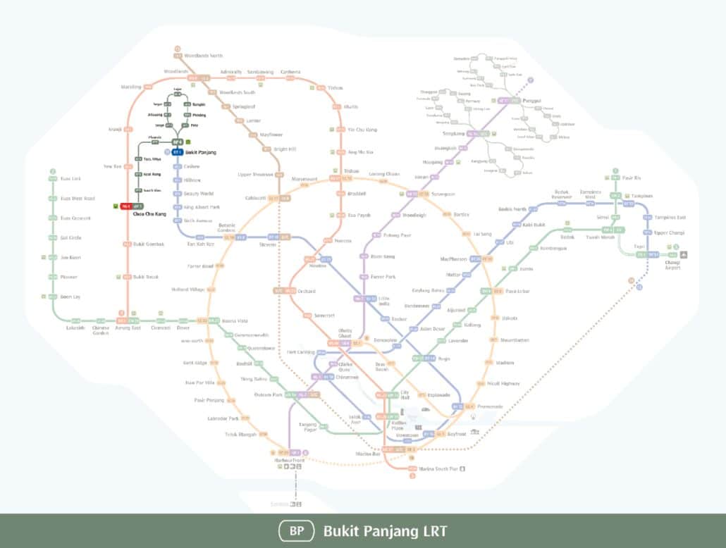
Singapore Bukit Panjang LRT Map The Bukit Panjang Light Rail Transit (LRT) is a driverless automated rail network serving the Bukit Panjang new town in the north-west of Singapore. It links the residential heartlands to the wider public transport network, giving residents a quick way in and out of the estate without needing a car. […]