
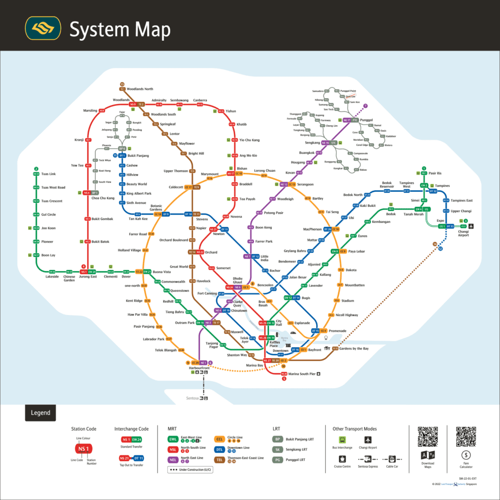
This is the official MRT map published by the Land Transport Authority (LTA). It covers the full Mass Rapid Transit network, showing all six MRT lines and three LRT systems across Singapore.
The network has grown considerably in recent years. Notable recent openings include Thomson-East Coast Line Stage 4 in June 2024, Punggol Coast on the North East Line in December 2024, Hume on the Downtown Line in February 2025, and the Circle Line Stage 6 completion in July 2026, which closed the loop between HarbourFront and Marina Bay via Keppel, Cantonment and Prince Edward Road.
How to read the official MRT map
The Land Transport Authority (LTA) plans and builds Singapore’s rail lines, while SMRT and SBS Transit run the trains. Its system map is the diagram you see in stations, and it follows a few simple rules. Each line has its own colour and letter code: red NS for the North South Line, green EW for the East West Line, purple NE for the North East Line, orange CC for the Circle Line, blue DT for the Downtown Line and brown TE for the Thomson-East Coast Line. The LRT systems feed into the MRT at Choa Chu Kang, Bukit Panjang, Sengkang and Punggol.
Interchange stations carry more than one code, such as Dhoby Ghaut (NS24, NE6, CC1), and are marked with a larger symbol. Stations that are built but not yet open, such as Mount Pleasant and Marina South on the Thomson-East Coast Line, are not served until they open. For a version you can zoom and print, use our MRT map PDF, or open the interactive MRT map.
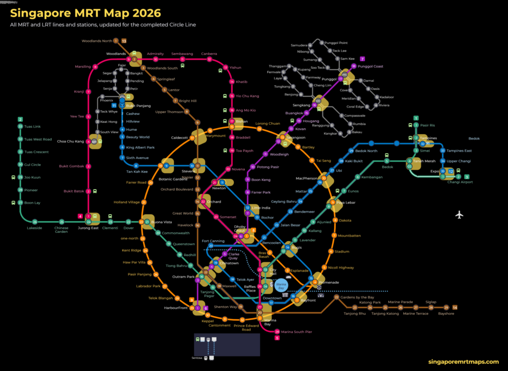
For the official version, see the LTA rail network map.
Getting around Singapore? Find any station on the interactive MRT map, or save the PDF map to use offline.