
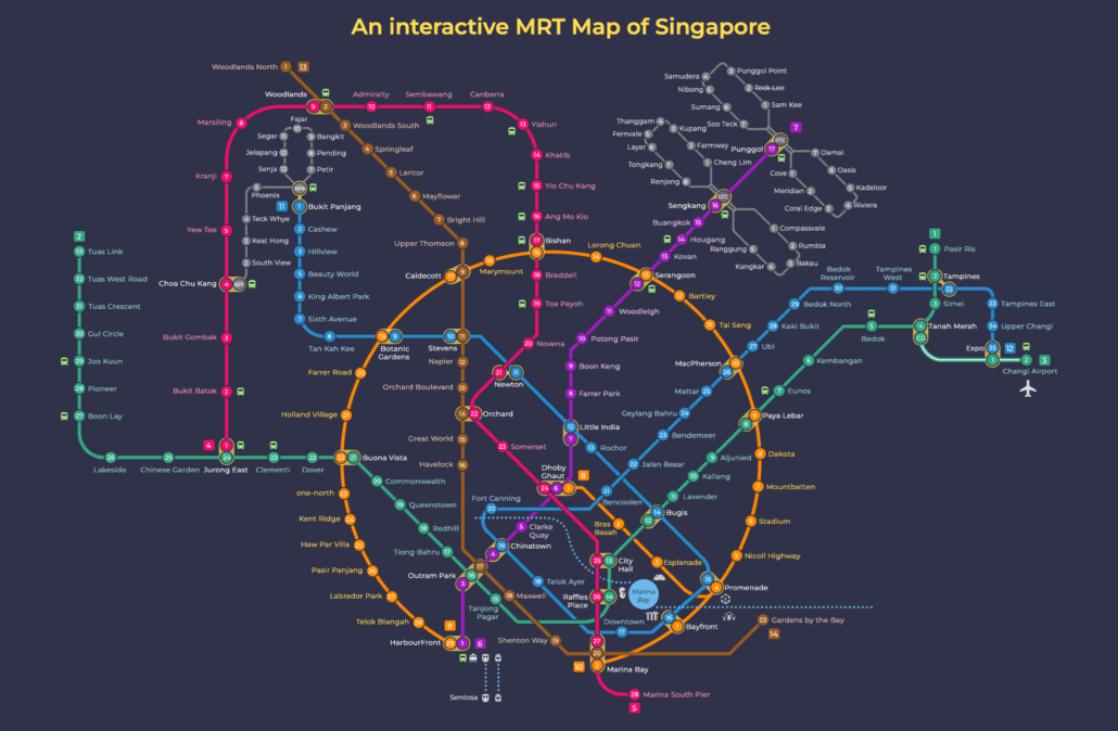
This MRT map dark mode version shows the full Singapore network on a dark background.
The Singapore MRT covers the whole island, linking neighbourhoods from Jurong in the west to Changi in the east, and Woodlands in the north to HarbourFront in the south. Whether you are heading to work, the airport, or somewhere new, every part of the city, including the Chinatown area, is within easy reach by train.
Why use the MRT map dark mode version
A dark background is easier on the eyes at night and on phone screens, and the bright line colours stand out clearly against it. It is handy when you check your route late in the evening, or on a platform where glare makes a white map hard to read. The layout, line colours and station codes are the same as on the standard map, so only the look changes.
Trains run from about 5.30am to around midnight, with later first trains on Sundays and public holidays, so check the last train before a late journey home. You can save this map to your phone to use offline, or grab the printable PDF. For the standard version with every line, see the current MRT map.
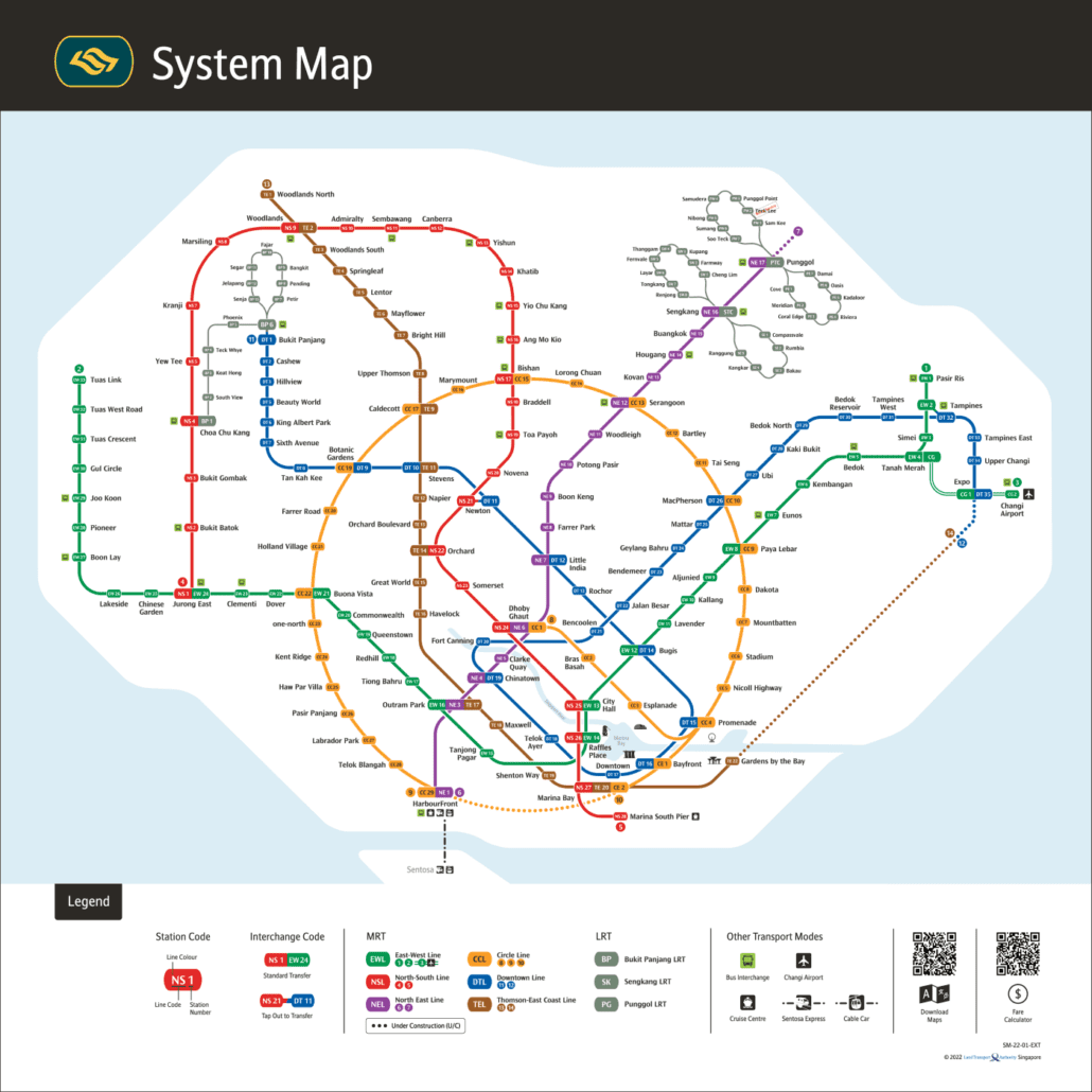
For the official version, see the LTA rail network map.
Getting around Singapore? Find any station on the interactive MRT map, or save the PDF map to use offline.