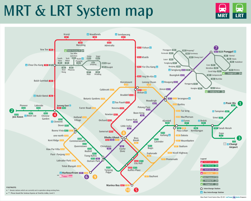
This page shows the MRT map 2011 edition, as the network looked that year. It is a useful reference for seeing how the network stood at that point, before several major expansions changed the picture. Use it to compare how far the system has come, or simply to understand the layout of the core lines.
By 2011, the MRT had grown to cover much of the island, with the North South, East West and North East lines already well established. The Circle Line had recently expanded, with Stages 4 and 5 from Marymount to HarbourFront opening on 8 October 2011. The map shows the network at that stage, before the Circle Line extension to Bayfront and Marina Bay in January 2012 and before the Downtown and Thomson-East Coast lines came along. If you want to explore individual stations or plan a trip using the current network, the main MRT map on this site is kept up to date and is a better starting point. Singapore has changed considerably since 2011, and so has its rail network.
What changed on the MRT map 2011
2011 was a big year for the Circle Line. Its first stretch, from Bartley to Marymount, opened in May 2009, and the Dhoby Ghaut to Bartley section followed in April 2010. On 8 October 2011 the line reached HarbourFront by way of Buona Vista and Pasir Panjang, so the orange line on this map curves around the west and north of the city centre. It still stopped short of Marina Bay, because Bayfront and Marina Bay only opened in January 2012.
Elsewhere, the East West Line had been extended west from Boon Lay to Pioneer and Joo Koon in 2009, and Woodleigh station on the North East Line opened in June 2011. There was no Downtown Line and no Thomson-East Coast Line yet, so the map shows four MRT lines plus the three LRT systems.
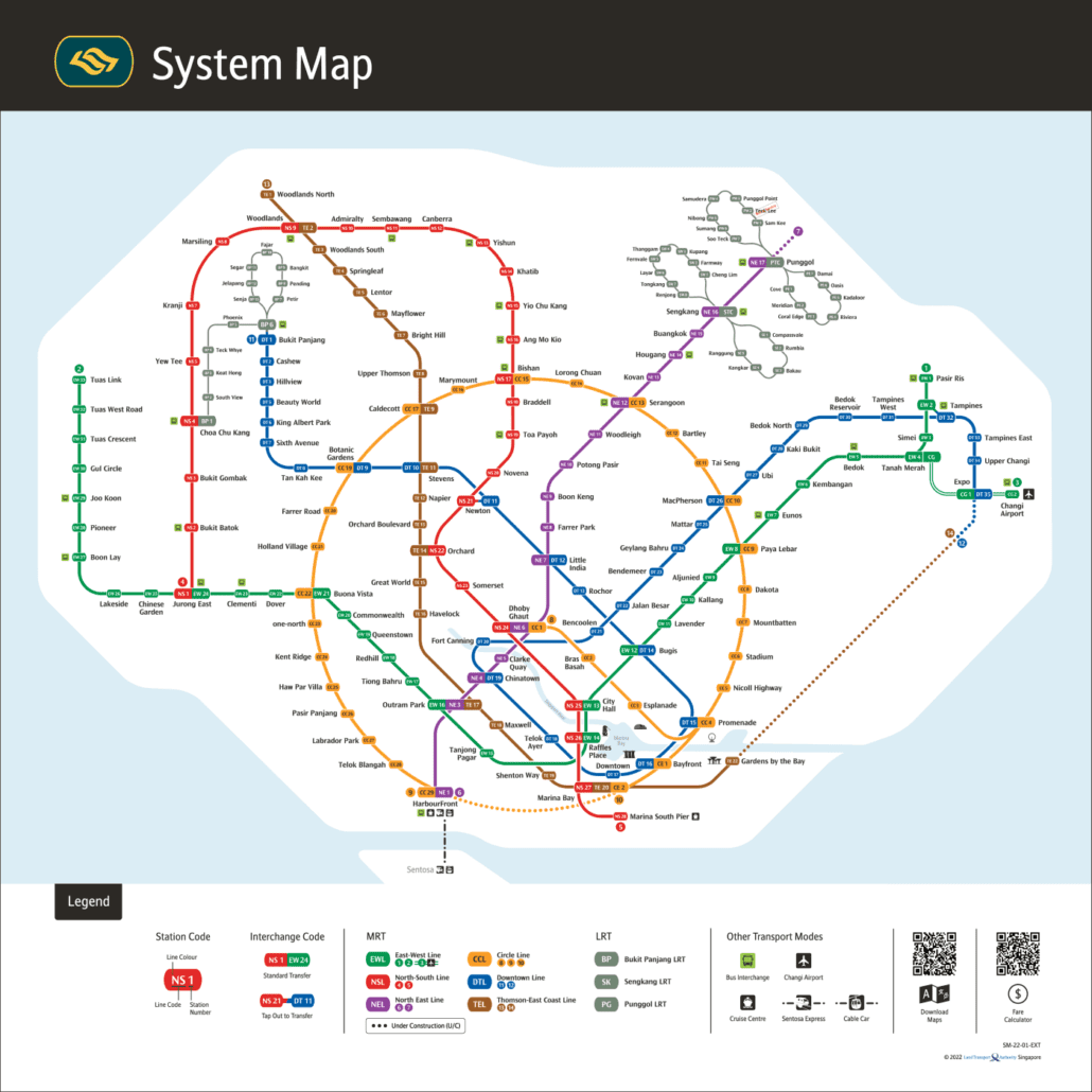
Put it next to the current MRT map and you can see how much has been added since: the Downtown Line, the Thomson-East Coast Line and, in July 2026, the final Circle Line stations at Keppel, Cantonment and Prince Edward Road that closed the loop. The Circle Line guide covers the full route.
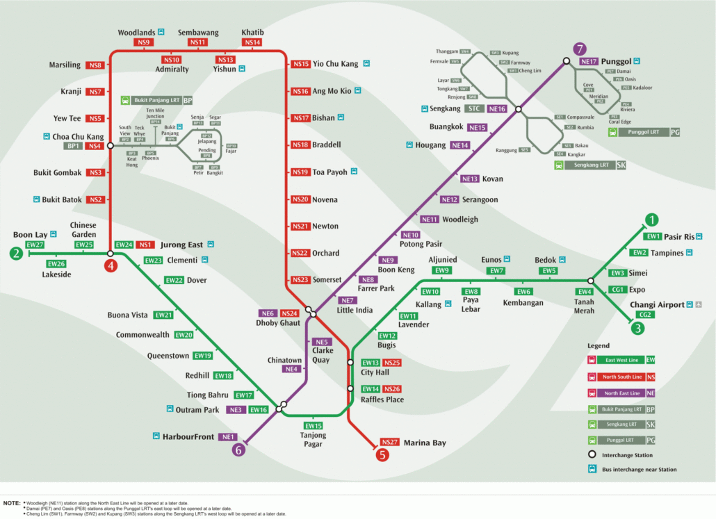
An earlier edition: the 2006 map.The network today: the official LTA system map for 2026.
The MRT Map of Singapore Editorial Team keeps the site's interactive MRT map, line guides and train times up to date using official LTA, SMRT and SBS Transit information. News posts are drafted with AI tools from published reports and official announcements. Spot a mistake? Tell us through our contact page and we will fix it.