

This MRT map 2016 shows Singapore’s rail network as it stood in 2016, after Downtown Line Stage 2 opened and before the major 2017 extensions. It is useful for checking old journeys, matching photos or documents to a date, and seeing how much the system has grown. For planning a trip today, use our interactive […]
Author Archives: MRT Map of Singapore Editorial Team

Blog
Singapore Rail Academy Expands: What It Means for Riders
The Singapore Rail Academy will bring technicians and operations staff into its courses and introduce [...]
Continue reading
26
Oct
Oct
Blog
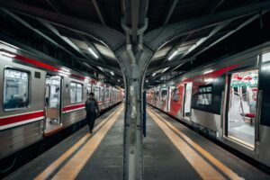
Lakeside MRT Delay: How to Beat the Morning Rush Queues
A brief delay during the morning rush on 21 October 2026 left long queues at [...]
Continue reading
22
Oct
Oct
Blog
Future MRT Map Singapore: Every New Line and Extension to 2040
The future MRT map of Singapore adds two completely new lines, the Jurong Region Line [...]
Continue reading
Blog
Labrador Park MRT: SMRT Staff Help Injured Cyclist
SMRT staff helped a cyclist with head and face injuries outside Labrador Park MRT and [...]
Continue reading
19
Oct
Oct
Blog
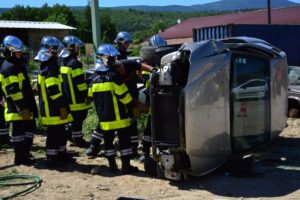
Chain collision of 3 buses in Yishun injures 5 riders
Five passengers were injured when a Tower Transit bus rear-ended an SBS Transit bus at [...]
Continue reading
16
Oct
Oct
11
Aug
Aug
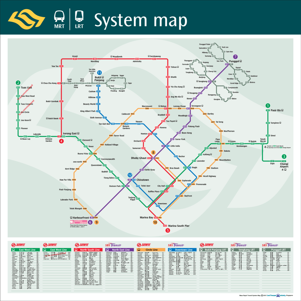
This MRT map 2015 shows Singapore’s rail network as it stood in 2015, before the Downtown Line was complete and before the Thomson East Coast Line existed. It is worth keeping as a record. The network was in the middle of a long expansion, and this map captures it partway. If you need to plan […]
11
Aug
Aug
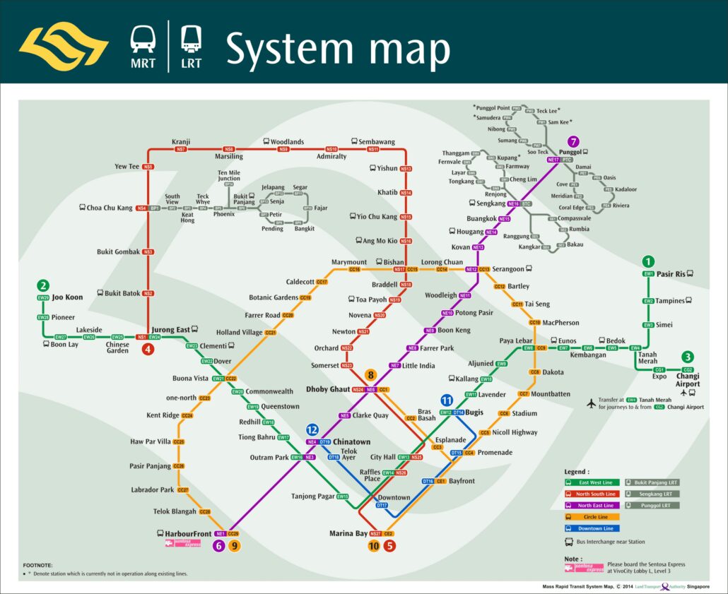
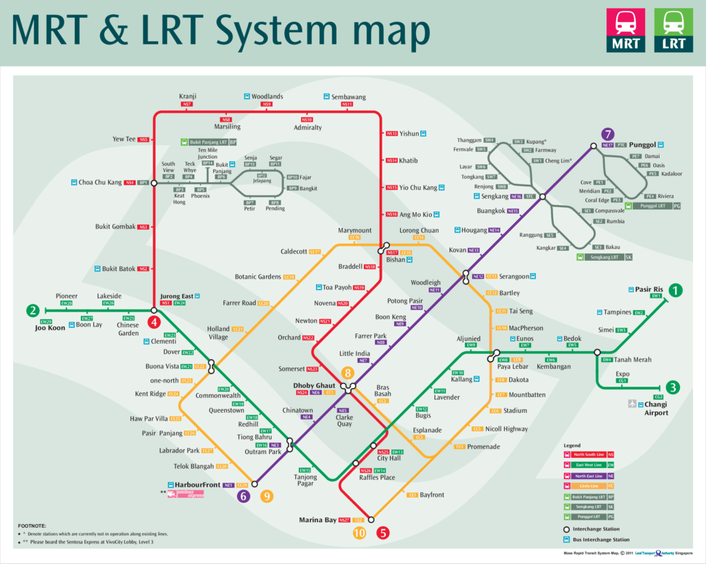
The MRT map 2014 is the official system map of Singapore’s rail network as it stood in 2014, shown in the image above. It captures a network in transition: the Circle Line was running, the first stage of the Downtown Line had only just opened, and the Thomson East Coast Line was still years away. […]
11
Aug
Aug
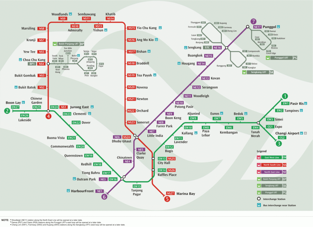
This MRT map 2011 shows Singapore’s rail network as it stood in 2011, before the Downtown Line or the Thomson East Coast Line existed. It is a useful snapshot of a system in transition. The North East Line had just gained a new station, and the Circle Line was still being opened in stages. If […]
11
Aug
Aug
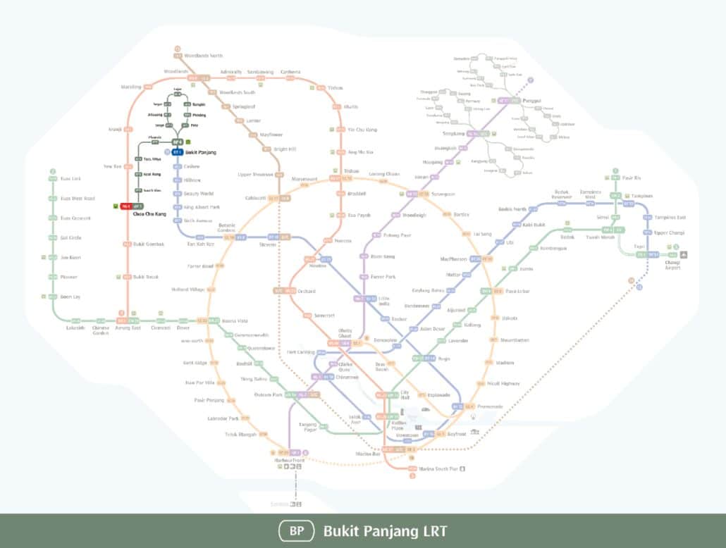
This MRT map 2006 shows Singapore’s rail network as it stood in 2006, a few years after the North East Line opened and a few years before the Circle Line arrived. It is a useful record of a smaller, simpler system: two long MRT lines built by the original operator, one newer automated line, and […]
11
Aug
Aug
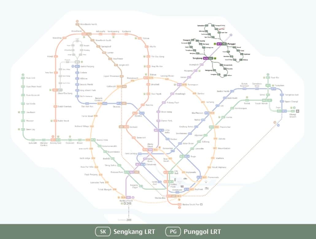
This Bukit Panjang LRT map shows the light rail line that serves Bukit Panjang and Choa Chu Kang in the west of Singapore, drawn in grey and coded BP on network signage. The line runs from Choa Chu Kang (BP1) to Senja (BP13), and all 13 of its stations are open. It works as a […]
11
Aug
Aug
The Sengkang Punggol LRT map above shows the four light rail loops that serve the Sengkang and Punggol estates in north east Singapore. Each loop runs out from a town hub station and back again. Sengkang LRT (codes SE and SW) and Punggol LRT (codes PE and PW) together have 27 open stations: 13 in […]
11
Aug
Aug
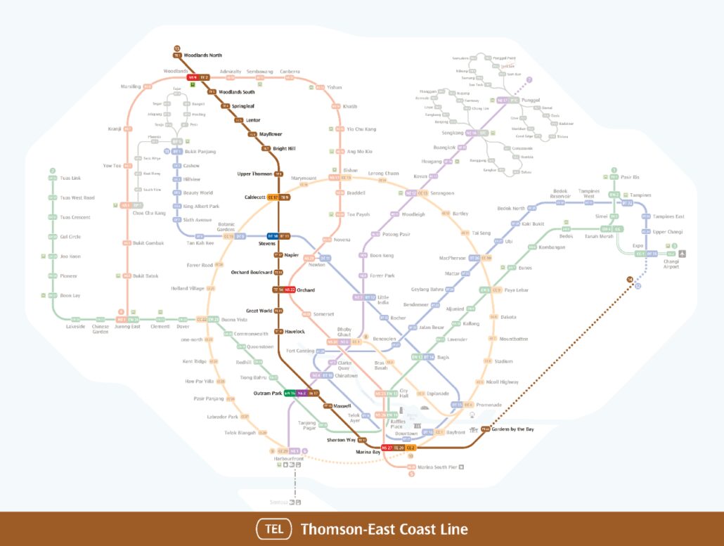
This Thomson-East Coast Line map shows the line Singaporeans often call the brown line, marked with the code TE and drawn in brown. It runs from Woodlands North (TE1) near the northern edge of the island, down through the city centre, and out along the east coast to Bayshore (TE29). There are 27 open stations […]
11
Aug
Aug
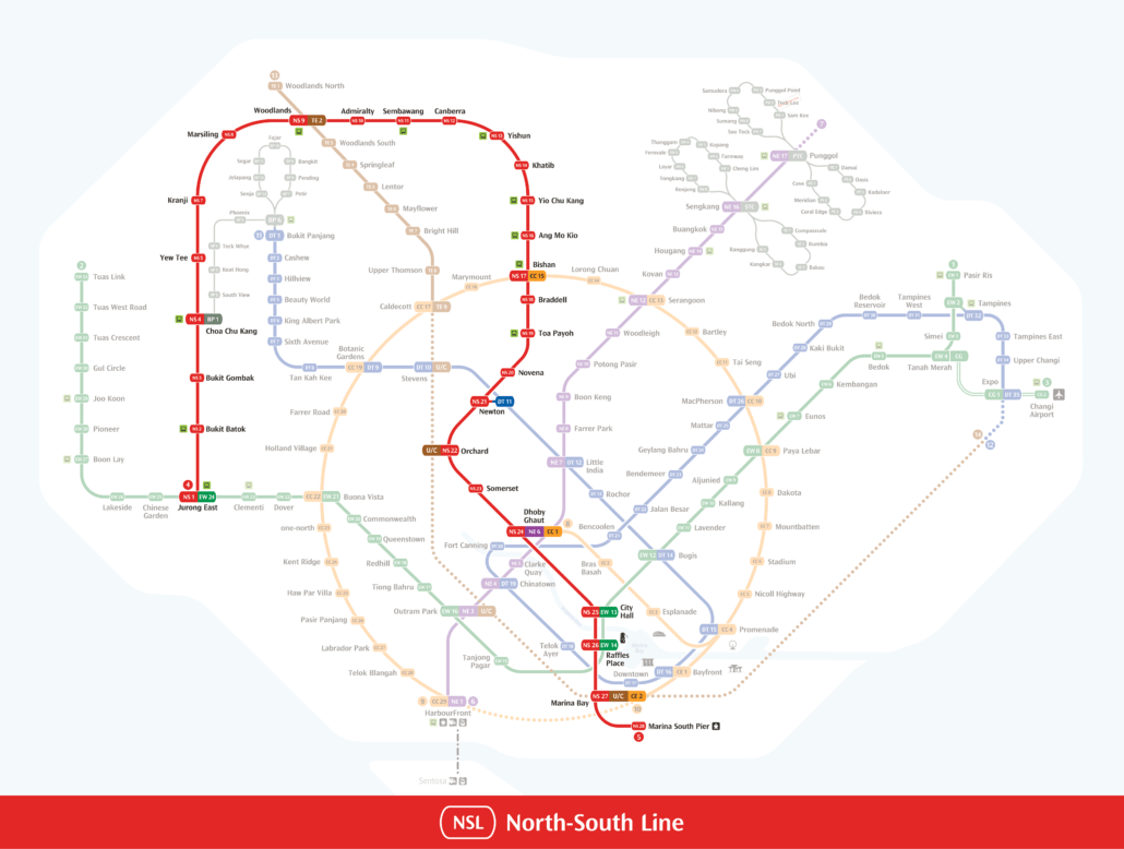
The North South Line map above traces the whole of Singapore’s red MRT line, coded NS, from Jurong East (NS1) in the west to Marina South Pier (NS28) on the southern waterfront. Twenty-seven stations are open today, and the line takes a long loop up through the north of the island before running straight down […]
11
Aug
Aug
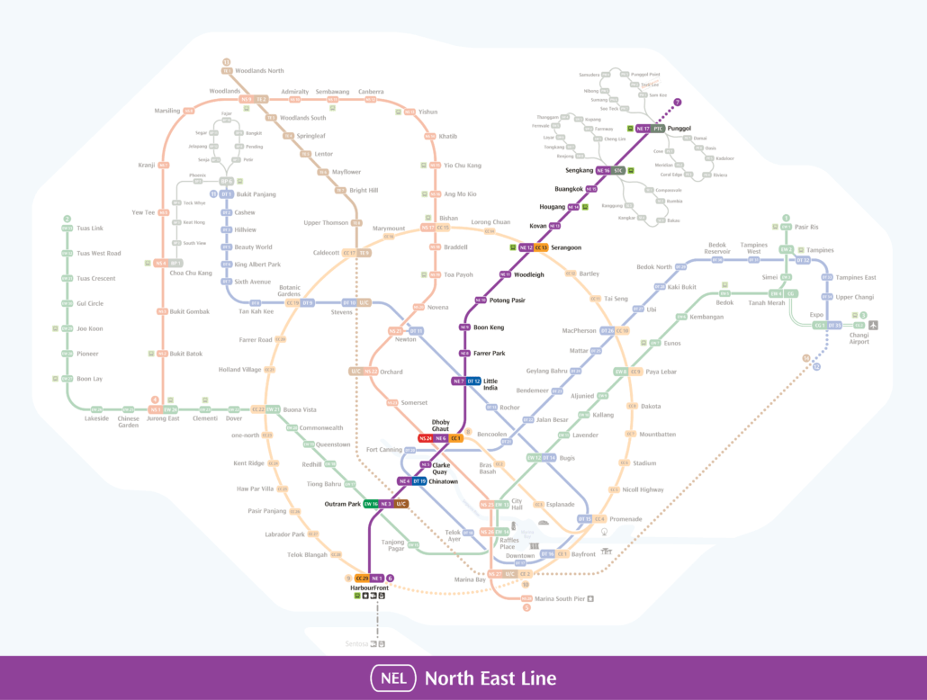
This North East Line map shows the full purple route of the NE line, running from HarbourFront (NE1) on the southern waterfront to Punggol Coast (NE18) in the far north east. Every station is marked with its NE code, and the interchange stops where you can change to other MRT lines or the Sengkang and […]