
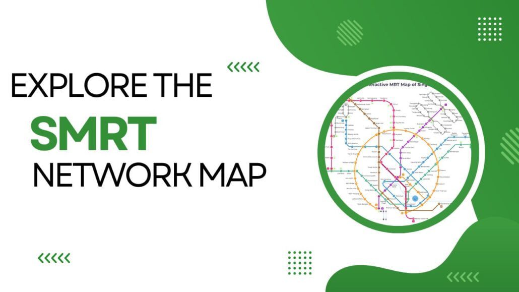
Want to travel around Singapore by train? The SMRT Network Map shows you every line, station and interchange so you can plan your journey before you leave home. Coverage is extensive, and most major attractions, neighbourhoods and transport hubs sit within easy walking distance of a station. This section walks you through the SMRT Network […]
Author Archives: MRT Map of Singapore Editorial Team
Blog
Singapore Rail Academy Expands: What It Means for Riders
The Singapore Rail Academy will bring technicians and operations staff into its courses and introduce [...]
Continue reading
26
Oct
Oct
Blog
Lakeside MRT Delay: How to Beat the Morning Rush Queues
A brief delay during the morning rush on 21 October 2026 left long queues at [...]
Continue reading
22
Oct
Oct
Blog
Future MRT Map Singapore: Every New Line and Extension to 2040
The future MRT map of Singapore adds two completely new lines, the Jurong Region Line [...]
Continue reading
Blog
Labrador Park MRT: SMRT Staff Help Injured Cyclist
SMRT staff helped a cyclist with head and face injuries outside Labrador Park MRT and [...]
Continue reading
19
Oct
Oct

Blog
Chain collision of 3 buses in Yishun injures 5 riders
Five passengers were injured when a Tower Transit bus rear-ended an SBS Transit bus at [...]
Continue reading
16
Oct
Oct
30
Jan
Jan
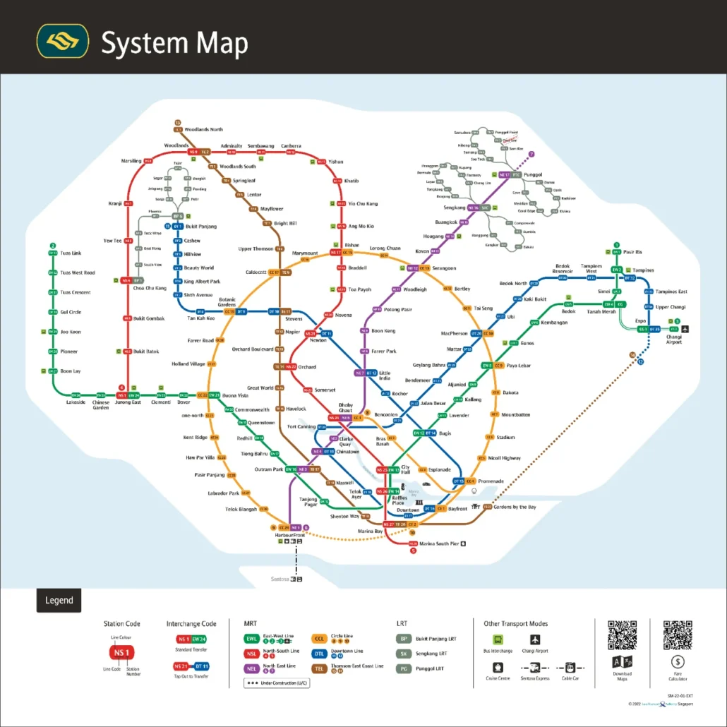
Singapore MRT Map PDF 2026 Download Updated for 2026: the PDF is the official Land Transport Authority system map, version dated 21 July 2026. It includes the completed Circle Line loop (Keppel, Cantonment and Prince Edward Road), Hume on the Downtown Line, Punggol Coast on the North East Line, and the Thomson-East Coast Line through […]

16
Nov
Nov
A Glimpse into the History of Singapore Botanic Gardens The gardens were founded in 1859 by an agri-horticultural society during the British colonial period. What began as a place for shared public enjoyment gradually grew into a serious research and conservation centre. The gardens also played a key role in shaping Singapore into a Garden […]

14
Nov
Nov
What Is the Singapore Food Festival? The Singapore Food Festival is an annual celebration of the city’s food culture, bringing together dishes that reflect its Chinese, Malay, Indian and Eurasian influences. Every edition gives you a chance to eat your way through that history in one place. Enjoy a Taste of Tradition: Classic Singaporean Dishes […]

14
Nov
Nov
The Singapore Fintech Festival is such a sign of innovation and progress in the fintech world that even its boastful brand name seems impossible to resist. Located in the heart of one of Asia’s premier financial centres, every year, it offers a lively stage where ideas can be traded, relationships cultivated and the latest breakthroughs […]
01
Nov
Nov
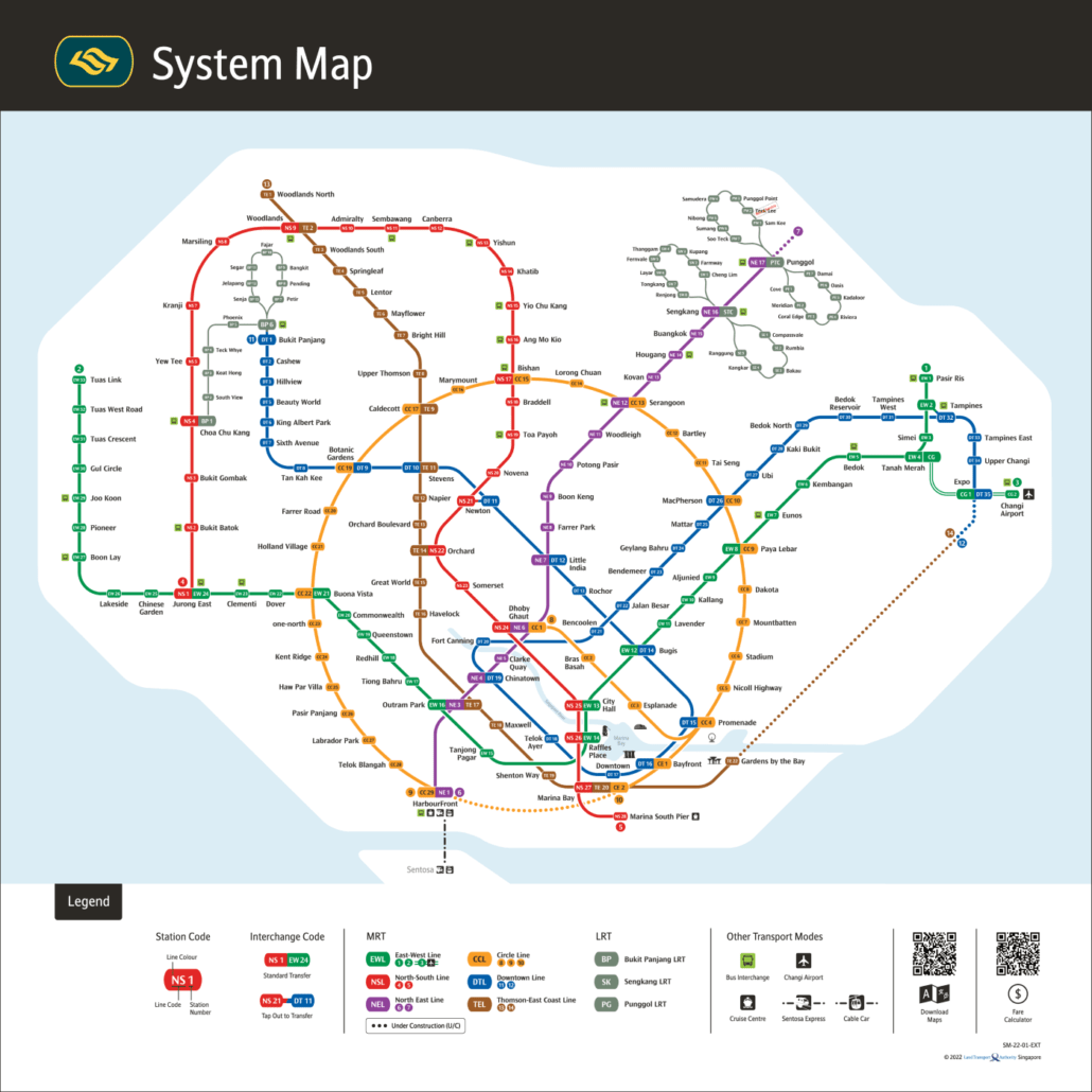
Getting around a new city can feel daunting, but Singapore’s Mass Rapid Transit (MRT) makes it straightforward. The network spans the whole island and is one of the most widely used forms of public transport in Singapore, connecting residential towns, business districts and attractions alike. Once you understand the MRT map, the city opens up: […]
31
Oct
Oct
Smart map technology, from the SMRT map to phone apps, is changing how people get around cities. It combines real-time data, advanced algorithms and artificial intelligence with traditional GPS to give you more accurate, up-to-date guidance. This page looks at how that technology works and what it means for getting around Singapore. SMRT Map: Redefining […]
31
Oct
Oct
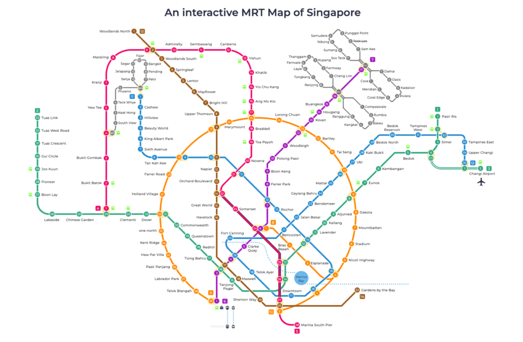
The Singapore MRT is one of the most reliable urban rail networks in the world. It spans the island with colour-coded lines, clear signage and frequent trains, making it easy to get around without a car. The Singapore MRT map is your best starting point for understanding how the network fits together. Quick Look at […]
11
Aug
Aug
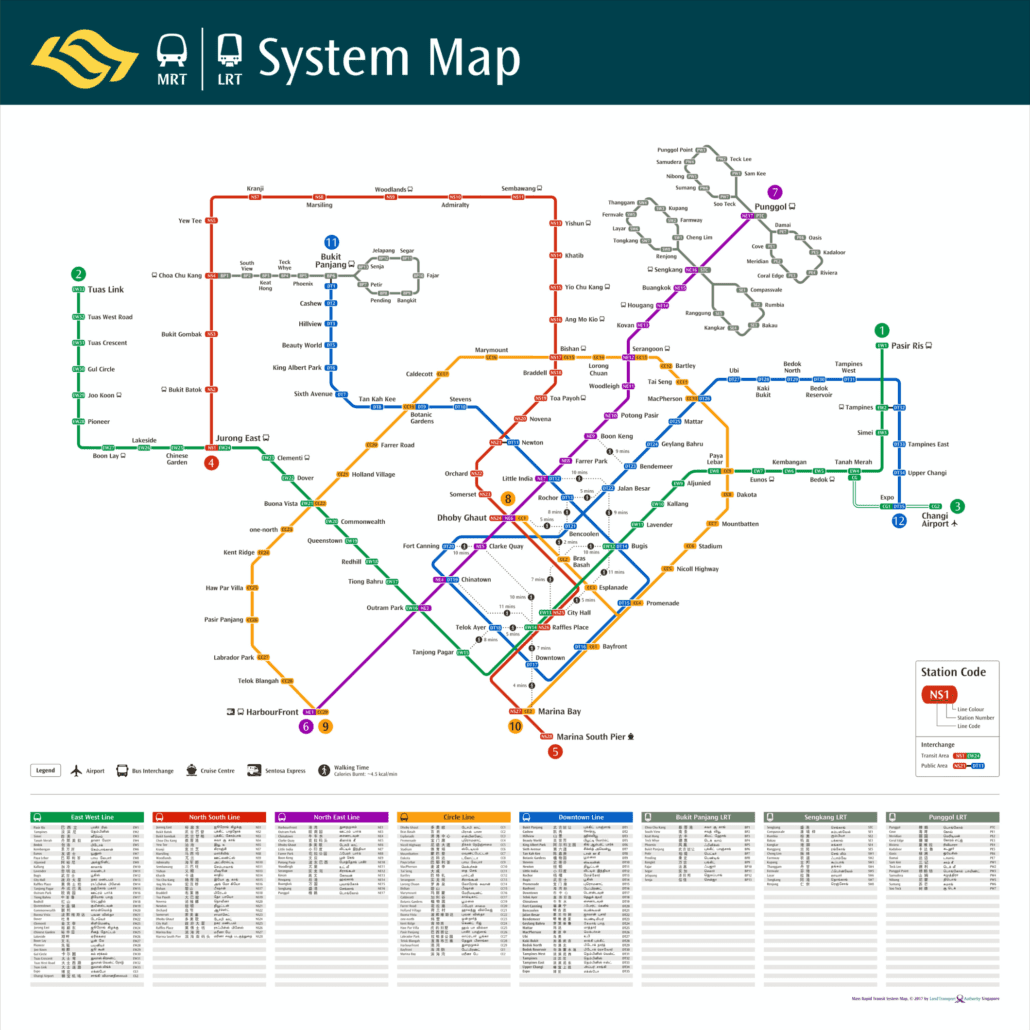
This MRT walking map is the 2017 Land Transport Authority system map with walking links added, showing the MRT and LRT network as it stood in late 2017 along with dotted lines between city centre stations that sit close enough to walk between. It records a network just after the East West Line reached Tuas […]

11
Aug
Aug
The MRT map 2017 shown above is Singapore’s rail system map as it stood in 2017, a year of real change for the network. It captures the system after the opening of the Tuas West Extension and around the arrival of the final stage of the Downtown Line, but well before the Thomson East Coast […]