
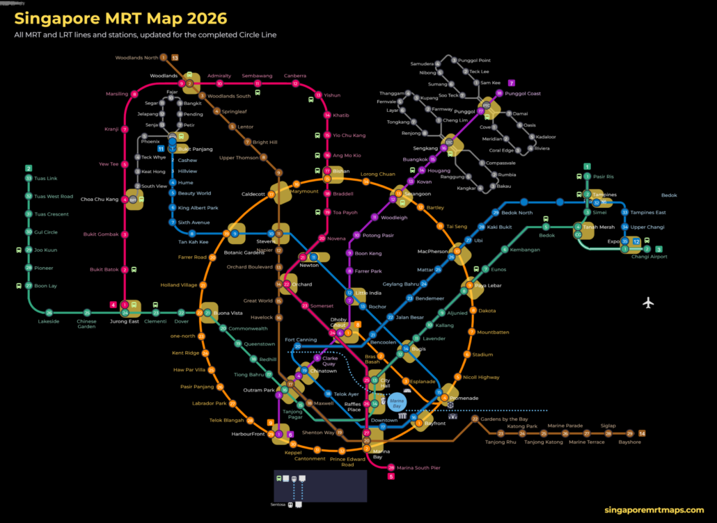
This SG MRT map is our own full-size image of Singapore’s rail network as it stands in October 2026. It shows every MRT and LRT line and station now in service, with stations that have not yet opened marked as future stops. We have updated it for the completed Circle Line, which became a full […]
Tag Archives: MRT Map
Blog
Singapore Rail Academy Expands: What It Means for Riders
The Singapore Rail Academy will bring technicians and operations staff into its courses and introduce [...]
Continue reading
26
Oct
Oct

Blog
Lakeside MRT Delay: How to Beat the Morning Rush Queues
A brief delay during the morning rush on 21 October 2026 left long queues at [...]
Continue reading
22
Oct
Oct
Blog
Future MRT Map Singapore: Every New Line and Extension to 2040
The future MRT map of Singapore adds two completely new lines, the Jurong Region Line [...]
Continue reading
Blog
Labrador Park MRT: SMRT Staff Help Injured Cyclist
SMRT staff helped a cyclist with head and face injuries outside Labrador Park MRT and [...]
Continue reading
19
Oct
Oct

Blog
Chain collision of 3 buses in Yishun injures 5 riders
Five passengers were injured when a Tower Transit bus rear-ended an SBS Transit bus at [...]
Continue reading
16
Oct
Oct
11
Aug
Aug
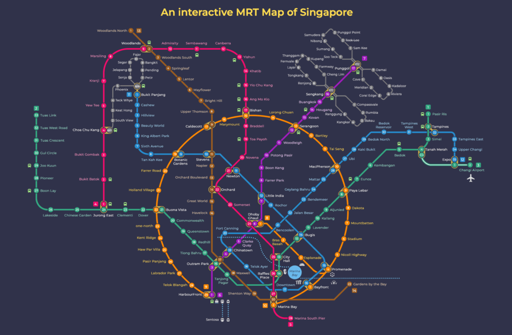
This MRT map dark mode version shows the full Singapore network on a dark background. The Singapore MRT covers the whole island, linking neighbourhoods from Jurong in the west to Changi in the east, and Woodlands in the north to HarbourFront in the south. Whether you are heading to work, the airport, or somewhere new, […]