
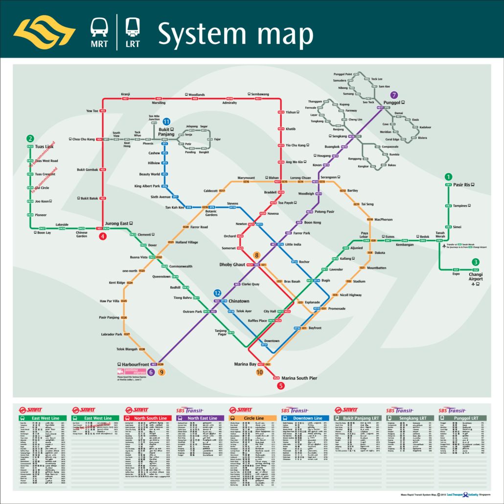
The MRT map 2015 at a glance
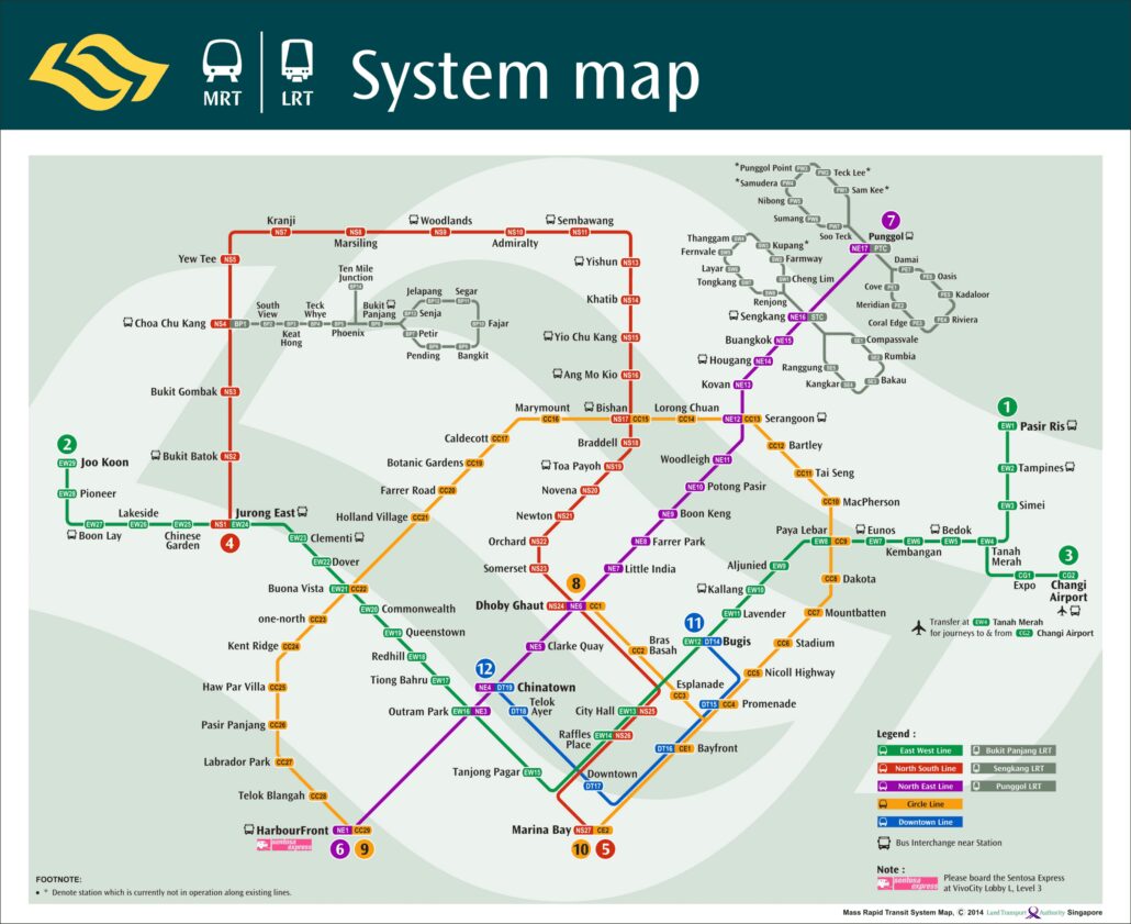
For most of 2015 the map looked much like the year before: the North South, East West, North East and Circle Lines, the first six Downtown Line stations in the city centre, and the three LRT systems. The change came at the very end of the year. On 27 December 2015 Downtown Line Stage 2 opened with 12 stations from Bukit Panjang to Rochor, running through Beauty World, Botanic Gardens, Stevens, Newton and Little India.
It gave the Bukit Timah corridor its first MRT service and created new interchanges at Bukit Panjang with the LRT, Botanic Gardens with the Circle Line, Newton with the North South Line and Little India with the North East Line. Maps printed after that date show the blue line stretching north west to Bukit Panjang, while the eastern section to Expo was still two years away.
See the current MRT map for the complete line, or read the Downtown Line guide for every station.
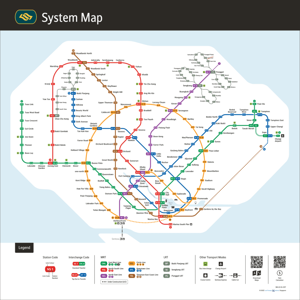
For the official version, see the LTA rail network map.
Getting around Singapore? Find any station on the interactive MRT map, or save the PDF map to use offline.