This Circle Line map shows all 33 stations on the orange line, which has run as a full loop since July 2026.
The Circle Line runs as a full loop around the city, covering about 39.5 km across 33 stations. The line connects a wide range of neighbourhoods, from the shops and cafes of Holland Village to the greenery around Botanic Gardens and the food options at Serangoon. It also links you to every other MRT line in the network, so changing trains is straightforward wherever you are headed.
The Circle Line became a complete loop in July 2026 when Stage 6 opened three new stations: Keppel CC30, Cantonment CC31 and Prince Edward Road CC32, closing the gap between HarbourFront and Marina Bay. You can now ride the full loop without needing to double back, which makes it useful for both daily commutes and exploring new parts of the city. Key interchange MRT stations along the line include Dhoby Ghaut, Serangoon, Bishan and Bayfront, each giving you quick access to other lines. Check the MRT Map to plan your route before you travel.
Reading the Circle Line map
The Circle Line is shown in orange, though many people call it the yellow line. It has 33 stations over about 39.5 km, uses the codes CC and CE, and is driverless and operated by SMRT. It opened in stages from 2009, and on 12 July 2026 Stage 6 added Keppel (CC30), Cantonment (CC31) and Prince Edward Road (CC32) between HarbourFront and Marina Bay, so the line now forms a full loop around the city.
Bayfront (CE1) and Marina Bay (CE2) keep their CE codes. Handy interchanges include Dhoby Ghaut, Bishan, Serangoon, Paya Lebar, Buona Vista and HarbourFront, plus the Downtown Line at Botanic Gardens, MacPherson, Promenade and Bayfront, and the Thomson-East Coast Line at Caldecott. If a map shows the line ending at HarbourFront, it dates from before July 2026. Read the Circle Line guide for every station.
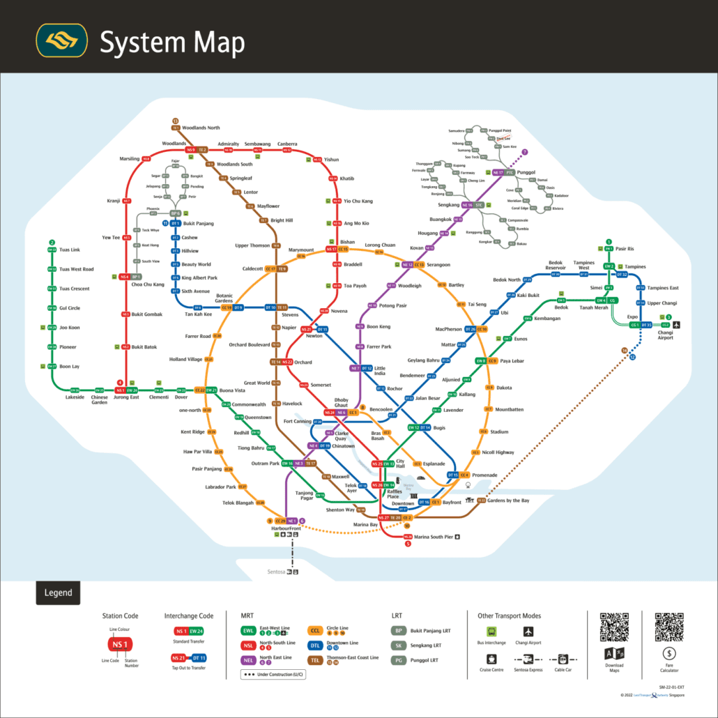
The network today: the official LTA system map for 2026.
The MRT Map of Singapore Editorial Team keeps the site's interactive MRT map, line guides and train times up to date using official LTA, SMRT and SBS Transit information. News posts are drafted with AI tools from published reports and official announcements. Spot a mistake? Tell us through our contact page and we will fix it.