
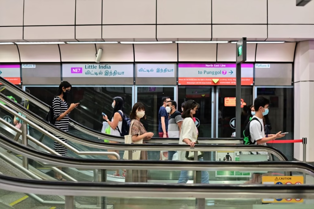
For over 30 years, Singapore’s Circle Line sat on planning documents as a circle that wasn’t actually a circle. That changed on 4 July 2026, when three brand-new stations opened for a free public preview, finally completing what is arguably the most technically ambitious chapter in the country’s MRT history.
In this guide
- What you need to know at a glance
- Why did the Circle Line take more than 30 years to complete?
- What are the three new CCL6 stations?
- How much shorter are journeys for affected commuters?
- What did LTA change about Circle Line wayfinding?
- What is there to do near the new CCL6 stations?
- How does CCL6 fit into Singapore’s broader rail expansion?
- Practical information: fares, first trains, and tapping in
- What does a completed Circle Line mean for Singapore’s MRT map?
- Before you tap in
- Frequently Asked Questions
What you need to know at a glance
- Three new stations: Keppel, Cantonment, and Prince Edward Road
- Free public preview launched on 4 July 2026
- Over 10,000 commuters expected to enjoy shorter daily journeys, according to The Straits Times
- The Land Transport Authority (LTA) updated wayfinding signs across Circle Line stations ahead of opening, following public feedback
- CCL6 closes the southern gap between HarbourFront and Bayfront, turning the yellow line into a genuine loop
Getting around Singapore? Find any station on the interactive MRT map, or save the PDF map to use offline.
Why did the Circle Line take more than 30 years to complete?
The Circle Line was first conceived in the late 1980s as a ring route that would link Singapore’s various MRT radials without forcing commuters to travel all the way into the CBD just to change lines. Brilliant idea in theory. In practice, completing the southern arc proved enormously complicated.
The stretch between HarbourFront and Bayfront runs through some of Singapore’s most sensitive and congested urban terrain. There’s the Tanjong Pagar port area, the old Keppel wharves, and the dense residential and commercial fabric around Cantonment Road. Tunnelling through this required careful sequencing alongside major land-use decisions that took years to resolve. Port relocation plans, land reclamation timelines, and shifting development priorities all dragged out the timeline.
Most Singaporeans have been riding the Circle Line since Stages 1 to 5 opened progressively between 2009 and 2012. That nagging gap in the south, though, always meant the line was technically a horseshoe, not a circle. Until now.
What are the three new CCL6 stations?
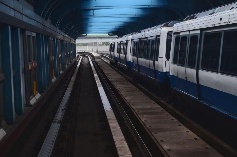
CCL6 adds three stations to the Circle Line, each serving a distinct neighbourhood in Singapore’s southern corridor.
Keppel (CC30)
Keppel station sits at the edge of the old Keppel Harbour district, an area transforming rapidly as the Greater Southern Waterfront takes shape over the coming decades. Right now it gives commuters direct rail access to the southern coast without having to travel via HarbourFront or Tanjong Pagar. Heading to the waterfront promenade or upcoming developments in that precinct? This is your stop.
Cantonment (CC31)
Cantonment is wedged between the existing urban fabric of Tanjong Pagar and the CBD’s southern fringe. You’ll find a mix of residential blocks, conservation shophouses, and commercial buildings here, so this station is likely to see a healthy blend of office commuters and residents. It also puts a portion of the southern CBD within walking distance of Circle Line access for the first time.
Prince Edward Road (CC32)
Prince Edward Road completes the trio and connects to the edge of the central business district. Together, these three stations finally stitch together a part of Singapore’s urban fabric that was always a bit awkward to reach by rail. Previously, getting to this corridor often meant a bus or a long walk from Tanjong Pagar on the East-West Line or a detour via HarbourFront on the North East Line.
How much shorter are journeys for affected commuters?
The Straits Times reported that more than 10,000 commuters will benefit from shorter rides now that CCL6 is open. The time savings vary depending on where you’re starting and where you’re going, but for someone travelling between the new southern stations and places like Serangoon, Bishan, or Dhoby Ghaut, avoiding the previous detour through HarbourFront or Tanjong Pagar shaves a meaningful chunk off the daily commute.
Here’s a rough comparison of how journeys change now that the loop is closed:
| From | To | Old route | New CCL6 route |
|---|---|---|---|
| Cantonment | Dhoby Ghaut | Bus or detour via EWL/CCL | Direct via Circle Line |
| Prince Edward Road | Bayfront | Change at Marina Bay (TEL/NSL) | Direct via Circle Line loop |
| Keppel | Bishan | HarbourFront then CCL (long arc) | Shorter arc via CCL6 |
| Keppel | Serangoon | Two changes, 40+ minutes | One line, reduced travel time |
The exact time saved depends on train frequency and walking time, but the pattern is clear: the southern CCL6 stations finally give that part of the island a direct rail spine to the rest of the network.
What did LTA change about Circle Line wayfinding?
Ahead of the CCL6 opening, the Land Transport Authority responded to public feedback by simplifying wayfinding signs across Circle Line stations. This matters because the Circle Line’s loop configuration has always confused commuters, particularly visitors trying to figure out whether to take the train clockwise or anti-clockwise to reach their destination.
The updated signs make the direction of travel clearer. You can read more about what changed in our article on Circle Line wayfinding sign improvements. The short version: LTA simplified the station direction indicators so you spend less time squinting at signs and more time actually boarding the right train.
What is there to do near the new CCL6 stations?
These stations aren’t just commuter stops. They open up some genuinely interesting parts of Singapore to easy rail access.
Around Keppel
Keppel is in the early stages of transformation as part of the Greater Southern Waterfront masterplan. Right now you’ve got the Mount Faber cable car terminal a short distance away, and the coastal park connectors that run along the southern shoreline. It’s a good starting point for a weekend walk along the waterfront. Sentosa is also nearby, and if you’re planning a trip there, our guide on getting to Sentosa via MRT has you covered.
Around Cantonment
Cantonment Road and the streets around it have a solid mix of old Singapore character and newer food and beverage spots. The Maxwell area with its famous hawker centre is within walking distance, which means you now have direct Circle Line access to some of the best chicken rice in the city. That alone might justify the 30-year wait.
Around Prince Edward Road
This station puts you close to the Tanjong Pagar conservation shophouses and the growing Duxton Hill dining belt. It also provides a more direct rail link for residents of nearby HDB blocks and condominiums who previously relied heavily on buses to reach the MRT network.
How does CCL6 fit into Singapore’s broader rail expansion?
Completing the Circle Line is a milestone, but it sits within a much larger period of network growth. The Thomson-East Coast Line (TEL) has been progressively opening its southern stages, and the Cross Island Line (CRL) is under construction with early stations expected to open in the early 2030s. Singapore’s approach has always been incremental: open what is ready, run it reliably, and build the next stage while the previous one beds in.
What CCL6 does is increase the overall resilience and utility of the existing network. A complete loop means there are now two rail paths between many station pairs on the Circle Line, giving commuters a genuine choice of route and reducing the impact of any single-point disruption. That is a quiet but significant operational improvement.
You can see how CCL6 fits into the full network picture on our Singapore MRT map for 2026, which has been updated to reflect all three new stations and their interchange connections.
Practical information: fares, first trains, and tapping in
Now that the public preview has ended, standard MRT distance-based fares apply at all three new stations. Adult fares on the Circle Line typically range from around S$0.92 for short hops up to S$2.17 or more for longer cross-network journeys, depending on your card type and any applicable concessions.
First and last train timings for CCL6 stations will align with the broader Circle Line operating schedule. The Circle Line generally runs from around 5.30am to midnight on weekdays, with slightly later start times on weekends. For exact timings, check our guide to MRT operating hours once CCL6 timings are confirmed by the operator.
Foreign visitors who want to explore these new stations as part of a broader city itinerary might want to consider the Singapore Tourist Pass for unlimited rides. Our breakdown of Tourist Pass versus EZ-Link versus SimplyGo lays out exactly which option saves you the most money depending on how many trips you’re making.
What does a completed Circle Line mean for Singapore’s MRT map?
A complete Circle Line changes the logic of how you plan MRT journeys in the southern part of the island. Previously, the gap forced most commuters heading between the southern waterfront area and the eastern or northern parts of the network to route through the city centre, adding time and platform transfers. Now there is a true orbital option.
For anyone who uses the full list of Singapore MRT stations to plan routes, the CCL now functions as it was always intended: a genuine circle that allows commuters to bypass the congested city-centre interchanges at Dhoby Ghaut, City Hall, and Raffles Place when those aren’t actually their destination. That is the whole point of a ring line, and it has taken three decades to fully realise.
Practically speaking, the Circle Line map looks rather different now. If you’ve been using an older version, the updated Circle Line map on this site shows all stations including the three new CCL6 additions in their correct positions.
Before you tap in
If you haven’t visited the new CCL6 stations yet, this weekend is as good a time as any. The southern waterfront makes for a genuinely pleasant afternoon out. Check our CCL6 public preview guide for the latest service updates, and browse the full Singapore MRT line guide if you want to plan a longer day out across the network.
Frequently Asked Questions
When did Circle Line Stage 6 open?
Circle Line Stage 6 opened for a free public preview on 4 July 2026. The three new stations are Keppel, Cantonment, and Prince Edward Road. Full commercial service with standard distance-based fares followed the preview period.
What are the three new Circle Line Stage 6 stations?
The three new CCL6 stations are Keppel (CC30), Cantonment (CC31), and Prince Edward Road (CC32). They fill the southern gap between HarbourFront and Bayfront, completing the Circle Line loop.
How does Circle Line Stage 6 make commutes shorter?
CCL6 closes the loop in the southern section of the Circle Line, meaning commuters travelling between the new stations and the eastern or northern parts of the network no longer need to detour through the city centre or change lines multiple times. The Straits Times reported that over 10,000 daily commuters benefit from the shorter routes.
What fares apply at the new Keppel, Cantonment, and Prince Edward Road MRT stations?
Standard distance-based MRT fares apply at all three CCL6 stations after the free preview period. Adult fares typically range from around S$0.92 for short trips to over S$2.17 for longer journeys, depending on your card type and concession status. You can calculate exact fares using the journey planner on the LTA website.
Why did it take more than 30 years to complete the Circle Line?
The Circle Line was first planned in the late 1980s, but completing the southern arc required tunnelling through some of Singapore’s most complex urban terrain, including the old Keppel port area and densely developed land around Cantonment Road. Decisions around port relocation, land reclamation, and shifting development priorities all contributed to the delay before CCL6 could finally be constructed and opened in 2026.
Earlier updates on this story
Circle Line Stage 6 Public Preview: Free Rides on 4 July 2026 (4 Jul 2026)
Tomorrow morning, three brand-new MRT stations are opening their doors to the public for the first time, and rides are completely free. The Circle Line Stage 6 (CCL6) public preview on 4 July 2026 is one of those rare chances to explore fresh infrastructure before the paying crowds arrive.
Circle Line Stage 6 extends the yellow line westward with three new stations: Keppel, Cantonment, and Prince Edward Road. Together they complete the missing link between HarbourFront (CC29) and Marina Bay (CE2), finally creating the full loop that Singaporeans have been waiting for.
New Circle Line Stations Open: CCL Finally Complete in 2026 (6 Jul 2026)
More than 10,000 commuters are already saving time on their daily journeys. On 4 July 2026, the Land Transport Authority (LTA) opened Keppel, Cantonment and Prince Edward Road stations for a public preview, finally closing the loop that planners first drew up in the early 1990s and completing the Circle Line (CCL).
Circle Line Stage 6 adds three stations to the southern stretch of the CCL, bridging the gap between HarbourFront and the existing network at Bayfront. The three stations are Keppel (CC30), Cantonment (CC31) and Prince Edward Road (CC32). Together they cover the corridor running through the southern fringe of the Central Business District (CBD) and into the Keppel waterfront precinct.
New Circle Line Stations: Shorter Rides for 10,000+ Commuters (8 Jul 2026)
More than 10,000 commuters are saving real time on their daily journeys now, and for many, it’s the difference between catching a connecting train or missing it. Between a relaxed morning and a stressful one.
This is genuinely a big deal. The Circle Line (CCL) has operated in an open-ended horseshoe shape for years, which always struck regular commuters as oddly incomplete. You could ride most of the way around Singapore’s core, but to complete the loop, you had to hop off and change to another line. That workaround is now gone.
CCL6 Stations Visited Ahead of Opening: Everything to Know (10 Jul 2026)
After more than 30 years, commuters in the Southern Corridor watched every other district get better rail access. That wait is over. The three new Circle Line Stage 6 stations, Keppel (CC30), Cantonment (CC31) and Prince Edward Road (CC32), opened for public preview on 4 July 2026 and are now fully operational.
We walked through all three stations before the official opening. Here is what you actually need to know: which exits to use, what the neighbourhood feels like, how much fares cost, and whether these stations fit your commute.
CCL6 Complete: Keppel, Cantonment & Prince Edward Road MRT (13 Jul 2026)
It took over 30 years, but Singapore’s Circle Line (CCL) finally closed its loop. Three brand-new stations, collectively known as CCL Stage 6 (CCL6), opened their fare gates to paying passengers on 12 July 2026, completing what is arguably the most anticipated chapter in the history of the local MRT network. The stations are Keppel (CC30), Cantonment (CC31) and Prince Edward Road (CC32).
If you’ve ever had to take a bus from Tanjong Pagar to HarbourFront, or suffered through a long detour via Dhoby Ghaut just to reach VivoCity from the CBD, you’ll understand exactly why this matters. The circle is now, well, an actual circle.
Circle Line Now Complete: CCL6 Opens July 2026 (17 Jul 2026)
Thirty-plus years of planning and construction came to an end on 12 July 2026, when Singapore’s Circle Line (CCL) became a genuine loop. Three new stations opened to fare-paying passengers that day: Keppel (CC30), Cantonment (CC31), and Prince Edward Road (CC32). The international headlines wrote themselves: metro opening takes Singapore passengers round in circles. For once, that is not a complaint.
If you catch the yellow line regularly, you already know how long this has felt. Trains from Dhoby Ghaut would arrive at HarbourFront and stop, a terminus that always seemed slightly unfinished. That awkward dead-end is now gone. Trains loop continuously through the southern arc, and commuters in Tanjong Pagar, Keppel, and Prince Edward Road areas finally have direct rail access without the old workaround of changing lines.
Singapore’s Three New Circle Line MRT Stations Explained (8 Aug 2026)
Singapore’s three newest MRT stations, Keppel (CC30), Cantonment (CC31) and Prince Edward Road (CC32), opened to the public in July 2026 as part of Circle Line Stage 6 (CCL6). This moment finally closes the loop on the Circle Line (CCL), a project that’s been incomplete since it first opened decades ago. For commuters in the southern corridor, this is what they’ve been waiting for.
But this isn’t just another transport milestone. Each station sits in a neighbourhood packed with history, and understanding that context explains why these locations matter, what’s being built around them, and what your commute will actually feel like.
Keep exploring
- Circle Line MRT Map and Station Guide
- Circle Line Wayfinding Signs Upgraded After Passenger Feedback