

A Snapshot of Singapore’s MRT Network in 2016
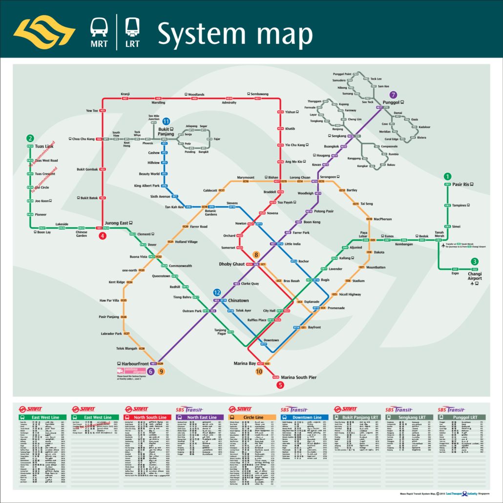
The MRT map 2016 edition captures the network at a particular moment of growth, before several major expansions changed the shape of the system. Looking back at it now, you can see clearly how much has changed since then.
By 2016, the network already spanned the island with five lines: the North South, East West, North East, Circle, and the then-recently opened Downtown Line stages. The Circle Line had completed its initial run from Dhoby Ghaut to HarbourFront with the Bayfront and Marina Bay extension in January 2012, while the Downtown Line was still rolling out its early stages. The Thomson-East Coast Line had not yet opened at all.
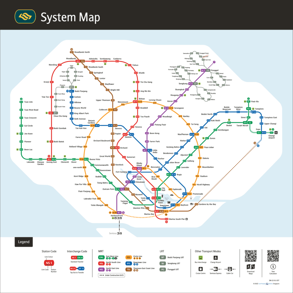
Comparing the 2016 map against the current network gives a useful sense of how quickly things have moved. New stations, new lines, and new connections have been added year on year since then, and the pace has not slowed.
Getting around Singapore? Find any station on the interactive MRT map, or save the PDF map to use offline.
Key Features of the MRT Map 2016
- Downtown Line (DTL): The most significant addition on the 2016 map was the Downtown Line. It gave residents in areas like Bukit Panjang and Bedok Reservoir a much faster route into the city centre, cutting out long bus trips or indirect MRT journeys. The line also brought more of Singapore within easy reach, including shopping, cultural and heritage areas that were previously less accessible by rail.
- Enhanced Connectivity: The 2016 map shows how new interchange stations improved connections across the network. Botanic Gardens, for example, became an interchange between the Downtown Line and the Circle Line, letting you switch between lines without backtracking to an earlier station. These additions reduced journey times noticeably for a wide range of cross-island trips.
- A Broader View of the City: The 2016 map captured how much of Singapore the MRT could take you to by that point. From Little India and Chinatown to Marina Bay, the network had grown into a practical way to explore the island rather than just commute to work and back.
The MRT Map in Everyday Life
The 2016 MRT map was more than a diagram of lines and stations. It captured where the network stood at a particular moment: a system that had grown steadily from a handful of routes into something that reached most corners of the island.
For the student heading to school, the working professional commuting across town, or the older resident keeping in touch with family, the map showed what was possible. It told you where you could go and how to get there, which is really all a good map needs to do.
Why Old Maps Still Matter
Looking back at the 2016 map now, what stands out is how much has changed since. Lines have extended, new stations have opened, and entirely new lines have been added. That gap between then and now is a useful reminder of how quickly the network moves forward.
Maps like this one are a record of a specific time, and that makes them worth keeping. If you want to see how the current Singapore MRT network looks today, the full updated map covers everything that has opened since.
For the official version, see the LTA rail network map.