
Strolling through a foreign city neither your people nor tongue can be overwhelming, but Singapore’s mass rapid transport (MRT) structure exists proof of accommodation and effectiveness. The MRT runs through the whole city-state and is one of the most significant public transport in Singapore, which carries passengers across the island. The MRT map is the key to a treasure trove that lies within one of my favourite cities in all of Asia, from impressive high-rises and residential buildings to verdant gardens.
The Anatomy of the Singapore MRT Map
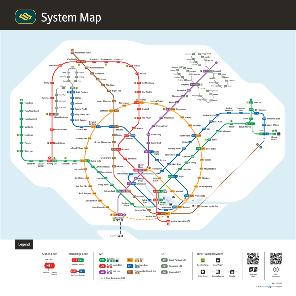
Singapore’s MRT system is the envy of many a public transport network for its on-time performance, cleanliness and reach. The MRT map is represented in colours, indicating different lines interconnecting each other to provide a full transit network.
Lines and Routes
The map of the MRT Singapore network is made up of several lines, and each one has its specific colours:
- North-South Line (Red): Travelling right through the middle of Singapore, this line takes you from Jurong East in the west to Marina South Pier down south.
- East-West Line (Green): The long and stretched-out green line that spans from Pasir Ris in the east to Tuas Link in the west.
- North-East Line (Purple): From Harbour Front to Punggol on the North-East Line (Purple).
- Circle Line (Yellow): This line circles the city, connecting places such as Paya Lebar and Bras Basah.
- Downtown Line (Blue): The recently opened downtown core stretches from Bukit Panjang to Expo.
- Thomson-East Coast Line Another underground stretch, this line is being progressively opened in various stages and will serve the northeastern parts of Singapore.
In addition to this, the LRT (Light Rail Transit) complements the MTR by providing transport for regional neighbourhoods with smaller and lighter trains.
Interchange Stations
Many MRT stations are interchanges, facilitating passengers to switch lines to different train lines without the need to enter/exit the station. An example would be City Hall and Raffles Place stations, where is are crucial interchanges for the North-South line intersecting with the East-West line.
Accessibility and Convenience
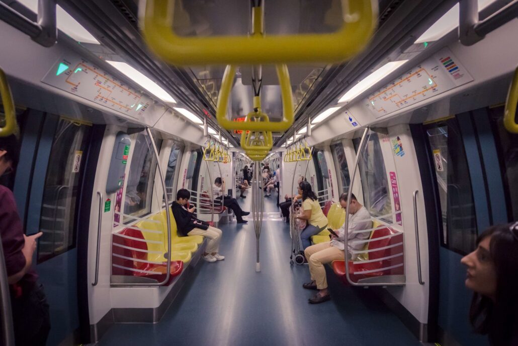
For the benefit of all passengers, lifts and ramps have been provided at every MRT station as well as tactile guidance for those who are visually challenged. In addition to that, the stations and trains are air-conditioned, a blessed relief for those bearing witness to Singapore’s tropical weather.
Navigating with Ease
Understanding the Map
Designed With the SMRT Map in Mind Stations are identified only by simplified symbols, and interchange stations have a specific design to show inter-crossing lines. MRT maps are visible on the platform, inside each train cabin, and electronic versions can be found in a mobile app by TransitLink or online trip planning websites.
Ticketing Options
Fares can be paid with contactless stored-value cards, the EZ-Link, or NETS FlashPay. You can buy these cards at any MRT station and top up whenever your balance is running out. One-way tickets (also for tourists or occasional users )
Timings and Frequency
Trains operate from roughly 5:30 AM to midnight each day, with peak headways as low as every 2-3 minutes. As a result, the waiting time for passengers is always short, even during peak hours.
Tips for a Smooth Journey
- Avoid Peak Hours: Travel off-peak if you can for a much more pleasant journey.
- Use Mobile Apps: Several mobile apps provide real-time information about train arrivals and crowd levels on the BTS, which will help you plan your route.
- Follow the Rules: Eating and drinking are prohibited on trains and in stations. Follow these rules to maintain a clean MRT for everyone.
Discovering Singapore through the MRT
Use the SMRT map to explore Singapore attractions easily The MRT takes you to Marina Bay Sands, Gardens by the Bay and Orchard Road (shopping), as well as cultural districts such as Chinatown and Little India.
With the SMRT map in hand, you can explore Singapore’s attractions with ease. Marina Bay Sands, Gardens by the Bay, the shopping paradise of Orchard Road, and cultural enclaves like Chinatown and Little India are all conveniently accessible by the MRT.
Conclusion
Not just a transportation network, Singapore’s MRT service is the heartbeat of the city that links different parts of it. With this guide and a map of SMRT, you’ll soon be getting to know the Lion City like clockwork – gliding off on an urban tour that would leave even machines in awe.
Plan your trip today and enjoy the panoramic features of Singapore’s great metropolis through the convenience of the MRT.
I hope this article gives an overall understanding of Singapore’s MRT system. It asks tourists and locals to open the window to green life overhead. The essay, having incorporated relevant keywords in the text, such as the Singapore MRT map and navigating Singapore public transportation in Singapore MRT stations tailored to search engines but still useful and readable for end users, indeed demonstrates our commitment to quality content.