

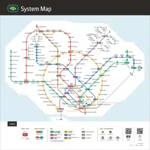


Singapore MRT Map from 2016 updated with markings for the new upcoming stations Have you ever been to Singapore? If yes, you probably know how intricate and vital the Mass Rapid Transit (MRT) system is. For newcomers and locals alike, the Singapore MRT map is like the DNA of Singaporean travel. Today, we’ll delve into […]
Category Archives: Blog

11
Aug
Aug
MRT map from 2015 with new stations added to the blue line The Emotive Journey Through Singapore’s MRT Map of 2015: Nostalgia on Rails Introduction Ah, the Singapore MRT Map of 2015! Remember that? In the days when smartphones were becoming the norm, paper maps still had their old-world charm. Imagine this: you just landed […]

11
Aug
Aug
This MRT map is from 2014. Displaying the first part of the additional fifth blue line. Exploring the Evolution of the MRT Map (2014) In the fast-paced urban landscapes of today, efficient public transportation systems play a pivotal role in shaping how people navigate cities. Singapore, known for its exemplary public transport system, introduced the […]

11
Aug
Aug
Historical MRT map from 2011 with four MRT lines Exploring the Singapore MRT Map of 2011: Navigating the Past The Singapore Mass Rapid Transit (MRT) system is renowned for its efficiency and connectivity, serving as the backbone of the city-state’s public transportation network. In this article, we’ll delve into the historical significance of the Singapore […]
11
Aug
Aug
This historical MRT Map is from 2006, with only three MRT lines. Singapore MRT Map (2006): Navigating the Urban Landscape The Singapore Mass Rapid Transit (MRT) system has long been an iconic symbol of the city-state’s efficient and well-connected urban transport network. As of 2006, the MRT map underwent significant development, reflecting the dynamic growth […]

11
Aug
Aug
Singapore Bukit Panjang LRT: Connecting Communities with Modern Transit In the bustling city-state of Singapore, where innovation and progress intertwine seamlessly, the Bukit Panjang Light Rail Transit (LRT) system is a testament to the nation’s commitment to efficient and convenient public transportation. Spanning the scenic and vibrant Bukit Panjang town, this LRT network has significantly […]

11
Aug
Aug
Serving two large residential estates in Singapore, the Sengkang and Punggol Light Rapid Transit (SPLRT) system operates fully driverless. Singapore Sengkang-Punggol LRT: Enhancing Commuting in the Heartlands Introduction In the bustling city-state of Singapore, urban planners have taken transportation to new heights with their innovative approach to public transit. The Singapore Sengkang-Punggol Light Rail Transit […]

11
Aug
Aug
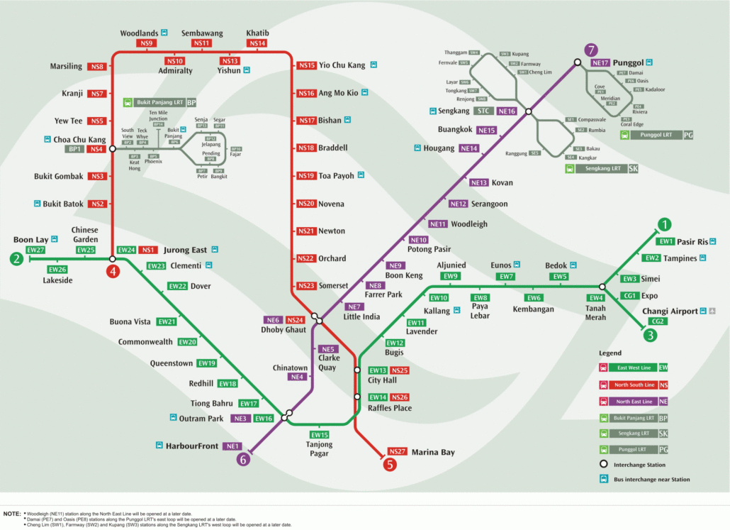
With four interchange stations that collectively link commuters on the Thomson-East Coast Line (TEL) to all other existing MRT lines. Singapore Thomson-East Coast Line Introduction Hey there, traveller! 🌏 Have you ever navigated through the intricate mesh of Singapore’s public transport system? If yes, then you’ve probably heard about the Thomson-East Coast Line map, the […]

11
Aug
Aug
Singapore’s first MRT line opened in 1987, connecting Yio Chu Kang to Toa Payoh with five stations……. Navigating the Singapore North-South Line Map: Your Ultimate Guide Introduction Hey there, savvy traveller! Planning to explore the iconic city-state of Singapore? One of the best ways to do so is by navigating its extensive train network. Specifically, […]

11
Aug
Aug
NEL connects residential neighborhoods in the northeast region of Singapore to the city fringe and heritage areas. Singapore North East Line Map Introduction to Singapore’s North East Line Welcome to Singapore! Or, if you’re a local, you already know how essential the public transport system is. One of the most crucial parts of that system […]